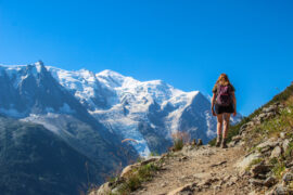
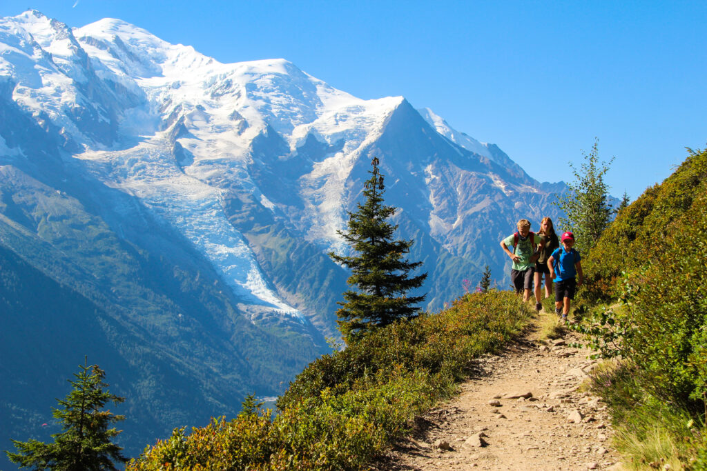
Hiking the Grand Balcon Sud Circuit, Mont Blanc in the background
Grand Balcon Sud circuit, Chamonix
The Grand Balcon Sud is renowned as being one of Europes greatest day hikes, offering up sublime views of the Mont Blanc massif. Most routes show this as a one way hike making use of the cable cars. That is not required as the hike can be completed as a circuit offering up stunning woodlands, ravines, rocky paths, rivers and at most times, one of the continents most phenomenal backdrops.
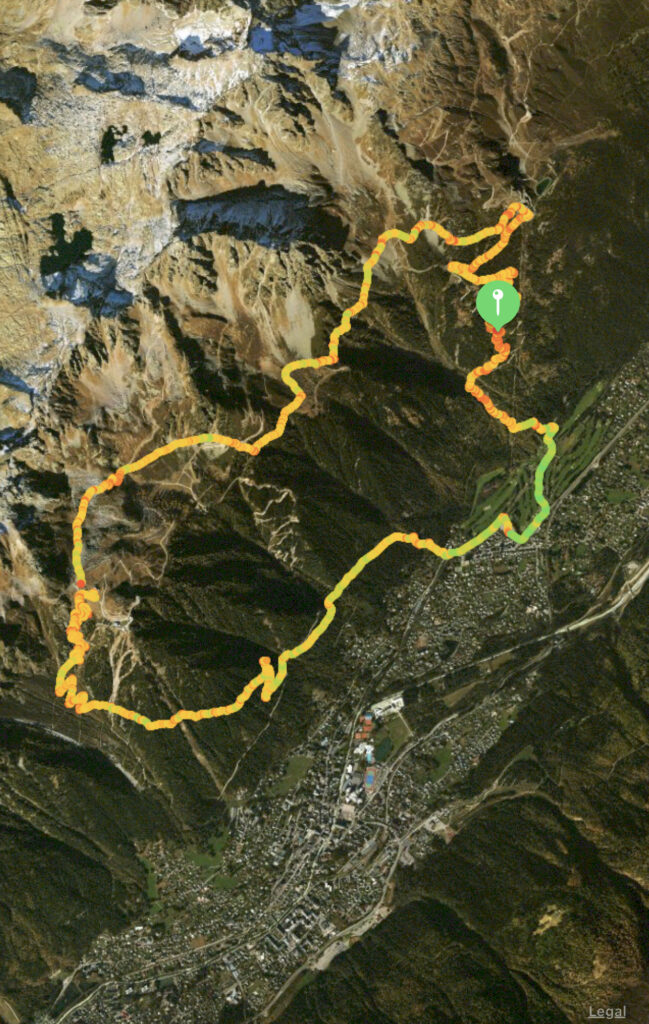
Start: LaFlégère, Chamonix
End: LaFlégère, Chamonix
Distance: 18km
Time: 5 – 7hrs
Elevation gain: 1102m
Difficulty: Moderate (Easy after first part of hike)
The route and hike I write about here is one that has been devised partially by myself, but probably exists somewhere. The Grand Balcon Sud is a panoramic hike that traverses between two cable cars, ‘LaFlégère’ and ‘Planpraz’. This hike takes a couple of hours and is 6.0km. The issue with this, is that it isn’t a circuit (though buses do run in Chamonix between the two, or it is a 3km walk). And that also, the cable cars cost about 18 Eur each way Which if you are a family of 5 as we were, costs a small fortune. Additionally, I love a good circuit so came up with a route that takes in the Grand Balcon Sud, but avoids using the cable cars.
Parking is free and plentiful in the area around the chair lift. There is also parking at the golf course and lots of on street parking nearby, all free.
Start: La Flégère, Chamonix
The first portion of the hike requires walking through the golf course also signed as ‘Paradis Les Praz’. Once at the end of the car park follow the river for 50m, then cross the river and pass the toilet walking up into the tree line. From this point on you should follow the signs for ‘ la Flégère’.
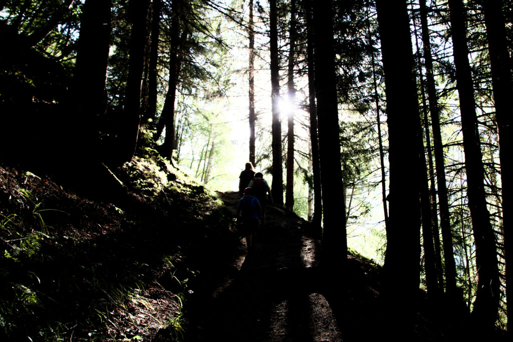
The next 3km are a punishing, repetition of grinding switchbacks that meander steeply up the mountain. We started the hike at 7am on an August day with temperatures lingering around the low 20C as we began, but climbed quickly to a high of 34C later in the day. The shade of the trees was a welcome respite from the brutal sun that blasts the length of the mountain all day.
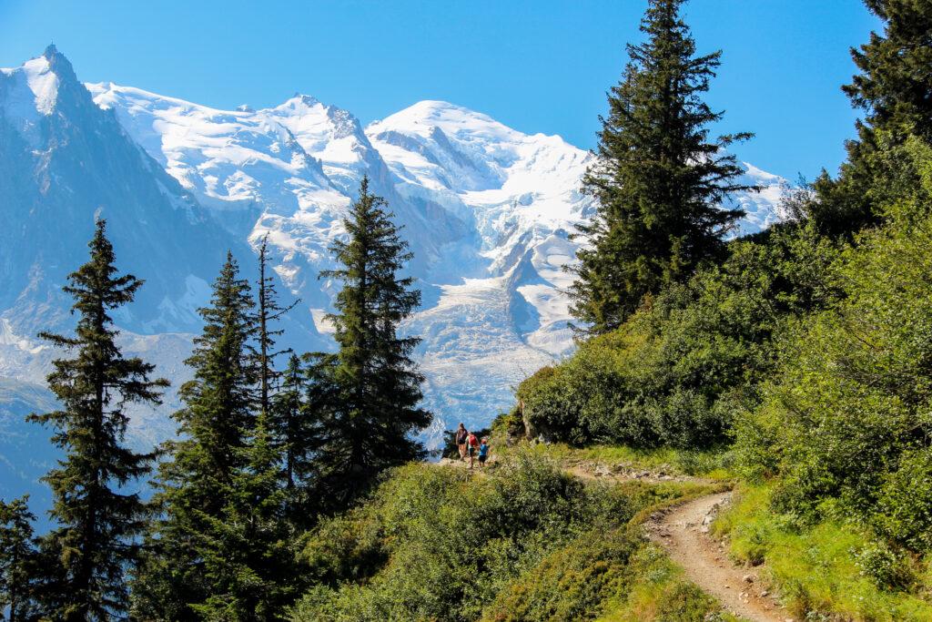
The path winds up through the alpine trees, the beauty of the this circuit is that the vast majority of elevation is covered here.
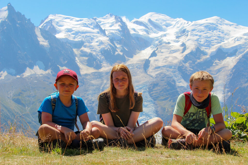
It took us 1hr 45mins to reach la Flégère and we had hiked 800m of elevation. Looking out over Mont Blanc was every bit as spectacular as I could have have imagined. The snow capped mountains paint the skyline a stunning mix of rock, snow and absolute beauty. You can hike even higher than la Flégère mid stop, covering another 600m of elevation and I did consider it. But for me, I wanted to feel the magnificence of the Mont Blanc massif which was by now about 2500m higher than us, I knew that in photographs it would still have the behemoth effect that would be reduced the higher you went.
You must now follow signs for ‘PlanPraz’, which begins below the cable car the lower left and in the direction of Mont Blanc. The hike itself traverses the side of the mountain, crossing rivers, meandering through woods and for the most part, offering up stunning views of the Mont Blanc massif.
The path is easy to follow and moderately busy, there is a total elevation gain on this route of just over 300m.
There are several opportunities for little side hikes along the route including some via ferrata, the famous La du Brevent, and the Brevent summit itself. I was hiking with an 8 year old on a brutally hot day, but if I didn’t have kids in tow, I would have followed the signs for ‘Via des Evettes’ after about 1.5km which would take you up to the wire bridges. I would then have walked along the ridge across the tops of the mountains and then descended from Brevent summit down to ‘PlanPraz’. All the while the Mont Blanc massif would have been the perfect backdrop.
It took us about 2 hours to reach PlanPraz, with the last leg of the hike taking the longest as this is now a single track hugging the hillside, that was quite busy making passing people awkward. When the path does open up, we arrived at PlanPraz for lunch and probably the best views of Mont Blanc anywhere around Chamonix.
From PlanPraz there are clear signposts of the path that descends back into Chamonix. Follow this as it hammers your knees for about 1000m of descent. If you have a map (or google maps), I had 4G signal for most of the route, then you can follow the paths right back through the woods to LaFlégère, Chamonix. All paths eventually lead to Chamonix if you are headed downwards so even if you get lost you will at least be in Chamonix where LaFlégère is well signposted, or wherever you chose to park.
This is without a doubt, on a clear day probably not only the best hike in France, but the best hike in Europe. Avoiding the cable cars makes this hike completely free, and the accomplishment of completing the circuit makes it worth every drop of sweat dripped on those switchbacks.
Generations ago Indonesians realised that they have something special. A gorgeously landscaped country that is virtually unrivalled, they knew it would attract visitors from far and wide and would eventually become the place for world class hikes, beaches, culture and history. Back when tourists first arrived on the shores of Java and made their way to Bali they were met with warm locals keen to share what they had with outside eyes. And word spread, those few visionaries have helped turn parts of Indonesia into places or pilgrimage for year round backpackers and Australians looking for sun during August.
The Indonesian government keen to get in on this tourist influx introduced eye watering split pricing that see’s tourists paying insanely excessive entry fees to anything worth seeing. Rumour has it a tourist was seen looking at a tree, as he walked away an Indonesian official quickly set up a ticket desk with fees similar to that of the observation deck at the Empire State Building in New York. The reality is, though many tourists shore up the extortionate fees many arrive expecting paradise and then are stunned to find they simply cannot afford it.
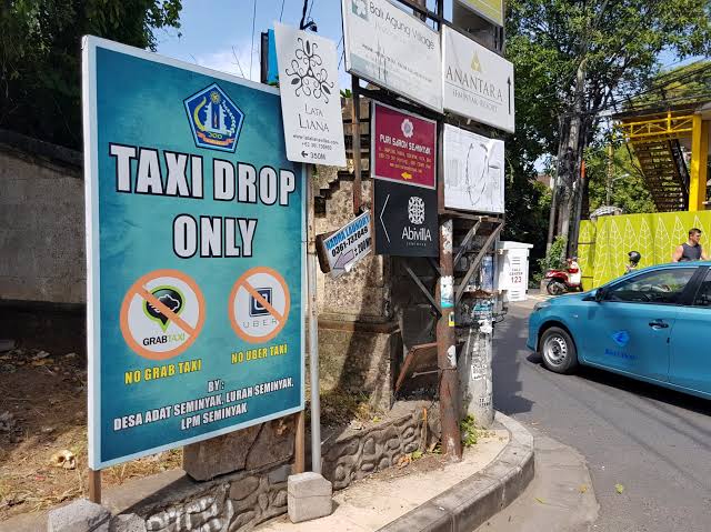
No where is scamming more blatant than with Grab in the following places: Probolinggo, Banyuwangi, Bali. When Grab first extended it’s reach to East Java and Bali, local taxi drivers that had spent years fleecing tourists were up in arms. Their excuse, they didn’t want international companies profiting at the expense of locals. I put that into google translate and it came out as following: They didn’t want tourists getting a fair price. Their argument is weak, many international companies operate in Indonesia. McDonald’s and KFC for example, surely they are taking money away from local Warungs? The reality is simple, these scumbag drivers that for decades have been refusing to use the meter, threatening tourists, and charging insane prices aren’t happy that they can longer feed their greed. So what do they do. They operate in areas on scooters and threaten Grab drivers. One driver refused to pick me up and made us walk a few hundred meters in Bali to meet him. He explained that the ‘taxi mafia’ threaten him with violence if he doesn’t pay them, and then leave the area not to return.
On my last trip to Bali I stayed at a place called Kosta Hostel near Seminyak, a no Grab pick up area. I walked outside the hostel with my bags and kids and a driver appeared out of nowhere asking where I was going. I asked if he would use the meter and he refused, saying that to go to Ubung bus terminal (for Java) was a fixed price of 300K. I walked away and another driver appeared, no meter, 500K. We walked about a mile, and used Grab. The ride cost 45K, but the driver refused to drop us at Ubung bus terminal because he said it was a ‘red zone’ and not safe for him.
This goes known, noticed and completely unpunished. You only have to do a search of Bali taxi reviews and you will see just how often tourists are scammed and just how desperate these conmen are at keeping going the famous and extremely boring Bali taxi scams.
Do yourself a favour, get Grab on your phone and check the price of a journey. Don’t be one of those tourists that compares the prices to those at home, you are not at home. Every time another tourist pays extortionate fees for a taxi ride these scumbags tick another box for a time to come. Walk a little, get Grab, and stay safe.
Without doubt though, Ubud is gorgeous. It really is, featured in Eat, Prey, Love it has attracted middle aged women trying to find themselves for the past few years and with them, naturally prices have risen. But, standards have remained consistent with even the stingiest of rooms being of a decent standard.
Accommodation in Ubud is largely homestay based and local Balinese are proud people who work hard, and aim to please. For those with cash to burn Ubud is also home to some of the most luxurious and most beautiful hotels in Asia. Think spas, tea light candles and massages for breakfast surrounded by rice fields. Then add ten thousand vehicles to roads designed to take a hundred and your first, and last memory of Ubud will be the torturous traffic that brings the entire place to a complete standstill.
The main road in the town is aptly called Monkey Forest rd due to the monkey forest at the end, which up until recently was a great value place to come face to face with Balinese monkeys, but now charges 70k per person., All the parallel roads leading from that eventually encompass a few other once independent villages. Temples dot the streets and in terms of Balinese culture it is perhaps as good as it gets.
Mainly Hindu, temples saturate the locality and offerings fill the streets. Everuy now and again you momentarily forget you are in Bali but have been transported to a cultural and beautifully manicured paradisiac of nature. High priced food, £2 for a can of coke and taxi fares to make your eyes water (read Grab in Indonesia) dominate this once sleepy village. Once perfect and quiet temples are now magnets for touts looking to exploit their own religion and a tenner might get you a traditional dance. But dig a little deeper and step beyond the tourist filled joints and you will find local Warungs trading great food for good prices. Warung Sun Sun was our favourite with mains from 22K.
Ubud and its surrounding villages sort of straddle ridges and there are many walks you can talk, such as the heavily congested Campuan ridge walk, first made famous by a few lines in a Lonely Planet guide book, and now a pilgrimage for every tourist in Ubud. But there are many more, most have trailheads marked on google maps.
Years ago on my first visit to Ubud I reflected on the hike:
As we passed scenery that would make it onto the pages of National Geographic we played games, kicked coconuts and sang songs whilst skipping through rice fields on the sly. It was perfection in a perfect place and we had finally found the side to Bali that people crave. We passed abandoned temples, walked through tiny villages and were the only foreigners in sight. Suddenly, a place we just could not love became paradise and nothing mattered. We had discovered that magic piece of something that had first drawn tourists to Bali in the seventies, that special moment and magical view that lives with you long after you have left. We found a local shop and I convinced the woman owner to make us a late lunch which cost us pence, and as we sat eating perhaps the cheapest meal on the entire island we looked out across rice fields and Jack (my son) did his gangam style dance. The kids played with a tiny dog called La la and free lollies were handed out. I realised that this was Bali, this was the Balinese and as much as I knew it was a temporary high and that we would soon head back to reality I knew this was a moment we should cherish.
Sadly hiking it again did not offer those feelings of enjoyment due to the sheer number of people.
Pretty much every local on the streets of Ubud is either a taxi driver, masseuse or offers a tour. And it seems the most popular tour is the ‘Instagram tour’. An overpriced, 6 hr jolly through the best places to take photos in Bali, starting with the so called Bali swing which will set you back 200K. However, if you head to Tegalalang and the rice fields you can get a go for 50K. Ignore anyone who tries to sell you a ticket to the area. It is completely free but again difficult to get a good photograph due to the amount of tourists.
So is it worth a visit to Ubud? Absolutely. So many people are there because it is that good, that beautiful and you are never far away from somewhere where no one is, but that is stunning and green. Taxis from Kuta should be around 250K, but like everything else in Bali, good luck.
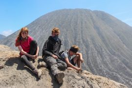
About 8 years ago I visited Bromo and Probolinggo and fell in love. It epitomised for me the rugged, natural beauty that volcanoes purveyed and seemed to be unrivalled. It was a masterpiece, an artists final work of art, one which when complete, would remain the pastel of his judgement.
Over the years Probolinggo has gained a reputation amongst backpackers and travellers as being a Javanese hotbed of scams and misery. Aptly referred to as ‘Scambolinggo’ by those that have had the recent unfortunate of passing through. And that is all most tourists do, they hop off the train and straight onto a tour of one of Java’s highlights, and then leave. Beyond Bromo the city has absolutely nothing of note, and any non-Muslims may be surprised to be woken multiple times during the night by the call to prayer which is loudly throughout the entire site and the inability to get alcohol almost anywhere in Probolinggo.
The scams in Probolinggo will start the second you arrive. Overpriced taxis run by the local mafia ensure you have to walk at least 100m down the road as Grab drivers are too scared to pick you up from the station (bus or train), and touts will feed you any lie they need to to get you to open your wallet. Common complaints regarding tours are that drivers randomly decide you want to go to some coffee tasting or other, or they charge hugely inflated prices that elsewhere in the region would be laughable. They have a monopoly, Grab won’t take you to Bromo, the little yellow Bemo’s will take you, but only at inflated prices.
Years of abuse and mismanagement by local regulators has meant entry prices to Bromo now stand at 210,000 – 310,000 (£13 weekday/£20 weekend) which is more expensive than the Louvre in Paris, The Taj Mahal in India and many other world class, world renowned museums/attractions . This a further kick in the face when you see locals pay about 600% less.
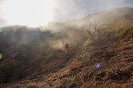
No doubt about, once you step into the Bromo basin you will be blown away by the natural beauty. It really is stunning. Yet the closer you get to Bromo you will begin to realise this stunning vista of lunar-esque beauty is teeming with litter, empty bottles, packets, bags, you name it. It is disgusting to see such a dirty place up close. Hike up the broken steps with rusty pieces of metal sticking out and you would be forgiven for wondering where the entry fees are really ending up. Mass tourism has made a decent photograph almost impossible and a lack of funding has meant that Bromo is now little ore than a dirty, unsafe pile of dust at the distant foot of Merapi. A mismanaged area of perfect driving into desperation fuelled by instagramers and filters that mask the dirt.
Leaving Probolinggo is where you will get hit the hardest by the scams. The bus ticket scams have been going on so long they are accepted by everyone, including every other person on your bus. The scam goes like this; You board the bus and some guy gets on with a ticket book looking official and tells you the fare (which is always hugely inflated). You look around and someone nearby tells you the guy is legit so you pay up. He jumps off, then the genuine ticket guy comes around and you have no ticket so pay again. This happened to me, but I was onto him and refused to pay.
The scamster stood up and shouted aggressively at me to pay, pay now, and for the driver to stop. The driver stopped and I was asking locals if this was genuine, everyone ignored me through absolute fear. I was being attempted to be charged 100,000 per person to Banyuwangi. The bus driver off loaded us, and we walked with our things about a mile, waited for the next bus, jumped on and paid the genuine fare. This has been happening for many years and goes unpunished, unregulated and really is a feed down for the absolute contempt everyone in Probolinggo has for foreigners.
Probolinggo is little more than a skid mark in Eastern java, a horrible little city filled with salivating, greedy Indonesians that are a far cry away from the warm, genuine, honest Indonesians you will meet elsewhere in the country. Probolinggo will taint your memory of Java, Bromo will be little more than a let down, and your whole experience of the place will be one of disgust and regret.
Bromo for free
However. There is a way you can get into Bromo with our paying the fee and it is really simple. Ask your driver to drop you off in Cemoro Lawang, at the turning point for the viewpoint. The hotel os called Cemara Indah, right by the mobile phone tower. The locals path goes from there and takes you to the basin completely free. And still, even without paying, I was disappointed.
The only way things might change in Probolinggo is if tourists stop feeding into the city wide scam that behests tourists. Money is all that matters in the city, and only if tourists refuse to feed the greed of the local authority, might someone actually start caring about Bromo for what it is, and not just the downtrodden cash cow it has become.
Java is a stunning island filled with great people who will always serve up a smile in passing, it has jaw dropping natural beauty, centuries old culture, is light on the wallet and a hikers paradise. For some, Java, Indonesia has it all.
Sadly, Java also has extortionate pricing for foreigners which hits families particularly hard. Charging $20 for ‘entry’ to walk up a mountain is bad enough, but a man with 3 kids, aka me, is slammed with an $80 fee for a day out. On top of extortionate fees to get out of pretty much any city in the country. So, when I rocked up to Yogyakarta with the intention of hiking up Merbabu, for those highly acclaimed views over Merapi and the region, I did so with 3 kids and the intention of doing it as cheaply as possible, and this meant not paying the scam fee for Merbabu.
Getting there
Public transport is available from Yogyakarta, websites say you should go via Magelang, you don’t need to. Take the bus to Muntilan, then to Ketap Pass, then onto Selo. The issue with this is that the first bust to Muntilan is not until 6am. We decided to take a grab for 195,000Rp (£12) left our hotel at 5am and was in Selo by 6.30am.
The vast majority of hikers from Yogyakarta hike the Selo route which is the trail from Seleo to Merbabu, they get ditched in Selo village then take an Ojek (motorbike) up to basecamp, pay their fee and head off. We had to avoid this. Being 4 people meant we couldn’t get an Ojek and after some discussion with a guy who wanted 150k to take us the 3km to the Guncik Basecamp we knew we had to walk. The Guncik trailhead (basecamp) is Bukit Gancik Selo Boyolai which is some crazy tourist attraction involving bikes and a wire.
The Hike
Here is the thing, every single step from Selo village to the summit of Merbabu is uphill and few places are steeper than the hike up the pavement from Selo trailhead to the Guncik trailhead. As we sweated up the hill, some guy appeared out of nowhere with impeccable English and started telling me how the Gancik trail was illegal and that we should detour to the Selo trail. Scam bells started ringing. Years of travel have taught me that whenever a young guy turns up out of nowhere and speaks almost fluent English he is scamming you. And he was. He ramped up his scam to level 10 telling me I would be in serious trouble if I hiked the Gancik trail and that he would drive us to the Selo Basecamp. I later realised that cars cant make it to the Gancik trailhead, which eventually becomes a scooter wide path, as steep as physically possible. My scam-o-meter had worked flawlessly.
The trail itself is well marked and and difficult to get wrong. Beginning at Bukit Gancik Selo Boyolali, a sort of tourist attraction where folks with nerves of steel and stupidity cycle across a wire high above the ground. The path is concrete into the forest and the turns into a dirt track that winds upwards. After maybe 90 minutes you meet with the first camping place, and this is where the trail from Selo joins, from this point onwards you are with anyone else on the trail.
Eventually you progress through a number of marked ‘POS’ which I can only assume are ‘positions’. Soon enough (it took us 4 hours) you are signposted for the summit. The hike itself is tough, especially in the heat, but made more difficult due to the amount of dust present and softness of the ground. Every step is literally like walking in sand, but uphill.
The summit is actually a double summit maybe 50 meters apart, both offering the same, stunning view above the clouds and as far as the coastline.
Hiking back down took longer than we had anticipated due to me going over on my knee making stepping on it painful. Total round trip from the village of Selo, back to the village of Selo took us 10 hours.
We took with us 3 litres of water each, some nuts and snacks, and when we realised there were no more buses back to Yogyakarta simply waved a driver down, offered him half a million and were snoozing our way back to Yogyakarta ready to hit town and grab some food by 9pm. Amazing hike, amazing views, amazing day.
So hike Merbabu, avoid the fees and use the must steeper, but much faster Gancik trail.
Malaysia is a stunning country that is home to amazing wildlife, great people, food, culture and one of the worlds great cities, Kuala Lumpur. But Malaysia hates foreigners. With a GDP of of almost a trillion dollars it ranks as the 25th largest economy on earth. Neither a third world country, or a developing one, Malaysia is steaming ahead at breakneck pace and cementing its place as one of the world’s great countries. In Malaysia I have seen stunning beaches, mountains, sunsets, sun rises and just about every other thing in between.
In short I love Malaysia. But Malaysia does not love me, or you, or any foreigner.
Roll up to KLIA and you are little more than a dollar sign to be rinsed for every last cent.
There is split pricing in Malaysia, what that means is that a local might pay 10 ringgit for something, but a foreigner might pay 30 ringgit for the exact same thing. It is endemic, every attraction however significant or insignificant will charge a foreigner more to gain entrance, or experience the same service. I know this happens in other countries, mostly developing, but Malaysia ramps it up to level ten.
If you are travelling with kids, babies in strollers, toddlers clung to your arm, if you don’t have a Malaysia student ID card for your nipper then you cannot prove that person is a child so you will be charged the adult price. Here is the thing, the student ID card is only available to Malaysians. That passport that gained you entrance to the country, nope. Not proof enough of your kids age.
Not content with ripping foreigners off with multi pricing, someone somewhere decided they would charge every single foreigner in Malaysia an extra 10 Ringgit per room per night. If you are a backpacker on a budget, paying about 40 ringgit for your dorm bed, then prepare to get slammed with a 25% tourism tax, on top of the 10% service tax and 6% local tax. Every night. And 10 ringgit might not be much, about $2.50, but if you are here for a few weeks that soon adds up, especially for budget travellers. I did try and research why the government charges this, but all I could find was reports of hotels disagreeing with the charge and saying it is damaging their businesses. So whilst the government leeches of foreigners, it is the people on the ground being hit with the reality of this.
Personally, I believe that the government realised that tourists were stung with multi pricing, and thought why not push it that bit further. Pure greed.
I was waiting for a bus recently, on the fringes of Kuala Lumpur. I had tried to get a taxi (Grab) but there was no service, the two options available was walking, and a bus. With 3 kids, and having just completed a hefty hike, we waited half an hour for a bus. One turned up. I boarded the bus and the driver told me I had to have a ‘touch and go’. I asked where I could get one from, and he responded “everywhere”, I had about $200 cash in my wallet and multiple debit/credit cards, I even had Apple Pay. Yet even though you could apparently get these touch and go things ‘everywhere’ the actual bus was not one of those places. I figured there was an app I could download, and there was. But you needed a Malaysian number to activate it, turns out this couldn’t be used anyway.
The driver refused to let us board and so we began a long walk back to Kuala Lumpur.
The funny thing is, though you are treated very clearly like a second class citizen in Malaysia, they have the audacity to announce 2020 as year of the tourist. I feel bad for the locals who have to face up this tourism tax, or the locals manning a ticket office explaining why a kid in a stroller has to pay adult price, or why a foreigner is charged hundreds of percent more, those are the people really hit by the greed of the Malaysian government. Well, not just those, but any foreigner who actually believed Malaysia was truly Asia. It isn’t. Head to Thailand, where you are not just loved, but loved long time.
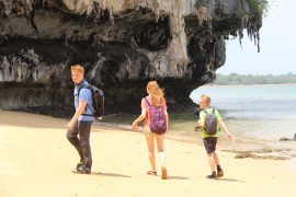
Railay beach is the highlight of the Krabi mainland area and with good reason. Every single person heading to the isolated beach does so using a long tail from either Ao Nang or Krabi. I wondered whether you could actually walk from Ao Nang to Railay, and after a bit of thought and planning realised that you can actually walk from Railay, or to Railay from Ao Nang.
If you are in Ao Nang you will likely get a long-tail from the beach, but if you head down to Ao Nam Mao pier, it is 100 Baht each, or 700 Baht for the full boat. Timed services run from 8.30am hourly until 6.30pm. If you walk a little further from the pier to the Arawan Krabi Beach Resort you will see a small little beach with some boats moored.This is where you start or end the walk to Railay from Ao Nang.
The only way this can be walked is if the tide is low, (Krabi, Ao Nang, Railay tide check) on the day we were there low tide was at 3.30pm, so we hopped in a long tail to Railay with the intention of walking back from Railay to Ao Nang.
Since I walked from Railay to Ao Nang you would obviously just follow this in reverse if walking from Ao Nang.
Start/end point for the walk between Railay and Ao Nang
The start point is the far end of the path just past Railay Viewpoint Resort. I have marked on the map, but you need to slip down onto the beach, walk to the steps up to Railay Great View Resort and Spa, but then slip down onto the adjacent beach, East facing beach. Literally you are now on the route back to Ao Nang. I was conscious of the tide, we left about 2pm and the fact that I had kids with me. The beach very soon becomes rocks, which are slippy, but not too much.
Just stick to the coast and eventually you will come to a part that looks impassable, it isn’t, there is a hole in the rocks meaning you can slip straight through and continue. There is also a part where you have to climb around a cliff face, but there are millions of hand holes and foot holes, just watch out for the crabs hiding in them.
Walk from Railay to Ao Nang, low tide essential
The walk was stunning. To know we were the only ones there, and doing something that few, if any people ever do was special.
The whole walk took us about an hour, but I was stopping to take photos and videos, powering it out alone, this could be done within half an hour. At no time did I feel like we were in any danger, and there seemed to be a number of places along the route to chill out if the tide did catch you off guard.
Climbing around the cliff on the walk between Railay and Ao Nang
There was me and 3 kids and so ultimately I only saved 400 Baht by doing this, but money wasn’t the driving factor, the adventure, experience and the fact that I had been told it couldn’t be done was enough.
So what you waiting for, walk from Ao nag to Railay, it is far easier than you are led to believe.
Most travellers to Phuket fly straight in, blow their load and then fly straight out. Yet for those that happen upon Phuket via the portal to Thailand; Bangkok, they are in for a shock. Read on to find out the costs in Phuket, and the best beach in Patong.
Grab is the taxi app of choice in the kingdom, and those that scoot around Bangkok will be well aware of just how much value for money the prices are, factor about 100 Baht for every 20 minutes or so. I mention taxis because this is the first thing that you will be knocked by the second you roll out of whatever it was you arrived on the island of Phuket on. 800 Baht is standard from the airport to pretty much anywhere. Hops from place to place on Phuket, often as little as 10km will cost minimum 400 baht (£10). Local public buses only seem to run from Phuket town but again, charge hefty fees upwards of 150 baht for jumps here and there.
If you are leaving Phuket on land, then you can get pummelled in any of the tour centres, or head straight to Bus Terminal 2 in Phuket town where a bus to Krabi and beyond costs from 153 Baht, which is pretty much the best value you will get on the island.
Food is expensive, happy hours are definitely not happy, and tat is overpriced. However, if you arrive in Phuket in the off season, which just happens to be Europes on season, then you will grab some decent bargains with accommodation starting at 500 Baht upwards for a fairly decent room in Patong.
Costs: (100 Baht = approx £2.50)
Taxi from town to town = 400+
Bus from the airport = 200 each or 800+
McDonald’s = 250
Sub of the day = 120
Beer at a random bar = 90+
Pizza = 260
Thai meal in a restaurant = 300+
Thai meal at street food = 100+
I get these prices still look cheap by western standards, but by Thai standards they are largely inflated.
The main places for backpackers and budget travellers to stay is Patong, Karon and Kata. In that order. Russians tend to congregate in Karon, clueless first timers in Kata, and everyone else in Patong. During summer the beaches of Karon and Kata are deadly, but Patong beach is the best of the three in terms of a surprise undercurrent you didn’t expect, or want.
The best beach in Patong; Chill Beach
Patong beach is home to Bangla walking street, bars, pubs, restaurants, tours, acrobats, street food, a McDonald’s on every street corner, live sex shows and everything in between. A hedonists paradise, there is no where else quite like Patong anywhere else in the country, not in cost, or experience. But Patong does not have the idyllic beach you might be looking for to nurse off a hangover.
Patong’s best beach
Paradise beach a few km up the road purports to be ‘paradise’, so off we went walking there. Every now and again a free shuttle passes us, which turns out was not actually a free shuttle at all. And when we finally got to Paradise beach we found it wasn’t paradise at all, a snide, dirty, overrun little slither of sand charging 200 Baht per person. If you walk back up the steep slope from paradise beach about 100m, then cut down the jungle style overgrowth, you will find what I would call paradise beach. A tiny piece of unoccupied sand, crystal clear water, and a random rope swing. The beach doesn’t have a name, so I have named it chill beach. Simply because, even though we found a snake there, it was pure chill from the heat and hassle of Patong.
All said, Patong is one of those places you have to visit, it is like few places you can imagine, and one of those places you can grab a beer, and walk around living, loving and enjoying life. Along with every other person there.
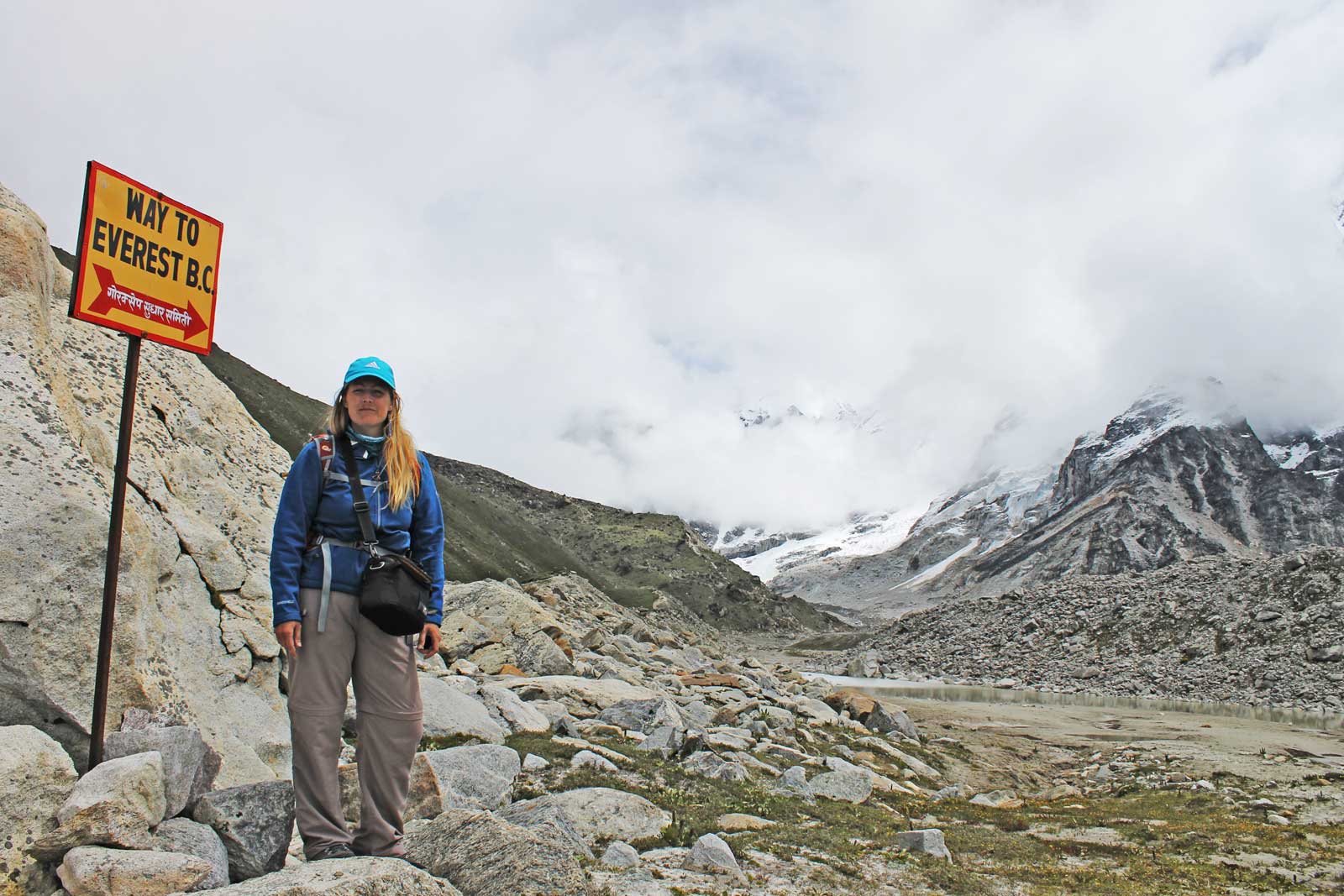
Mount Everest, the highest mountain on earth, a magnet for
mountaineers for decades and a regular pilgrimage for adventurous backpackers
seeking a view of highest point on our earth. Snow-capped, savage, but beautiful
in its aura, hikers push themselves to their limits to stand in its awe, and to
soak in the amazement and wonder of this iconic peak.
Hiking to Everest base-camp (EBC Trek) is for most people, as close as they will ever get to the mountain. For just about every person that hikes the EBC camp trail, it will be a dream come true and form memories that will last a lifetime.
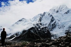
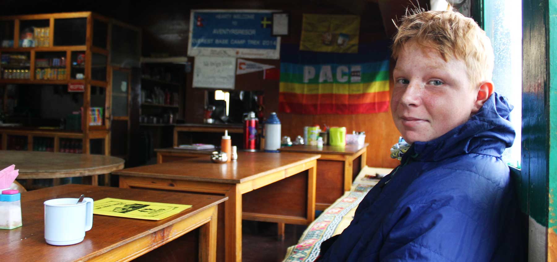
Having already hiked all over the world with kids the Everest Base camp Trail had been a dream of mine, and my stepson for years. Just 14 years old, I wondered if it was a step too far. I was unfit, we had very little time, and it would mean a harsh regime of training, planning and ultimately, taking ‘that’ flight into Lukla.
We completed the West Highland Way in April, and on the
journey back to our home in Yorkshire I knew we could do it. I looked at
Charlie, nodded and said “lets do the EBC”. He smiled. It was on.
Getting from Kathmandu to Lukla
Hiking
It used to be a flight, or a long walk from Jiri was your
only realistic option into Lukla. As Nepalese infrastructure within the region
has ploughed ahead, the road now reaches Phaplu or Salleri which shaves a few
days off the Jiri hike. It is worth pointing out that if you walk in to the EBC
trail, you can avoid Lukla altogether as the trail leads directly to the EBC. This
road is very much a work in progress, albeit a slow one, but the distance is
increasing year on year.
Flying from Kathmandu to Lukla
The flight from Kathmandu to Lukla with kids
The way it works with local airlines in Nepal, is that you
buy a return ticket. Flights are so regularly cancelled that the date on your
ticket often doesn’t mean much. During summer flights only really happen in the
mornings as once cloud comes in, flights can no longer take off. The biggest
issue with flights is that you can never guarantee your dates. Until of course
you actually get to the airport and are hurtling down the run way.
Typically, you are told to be at the airport at a certain time, we rolled up and the airport wasn’t even open. Thankfully we found a door that in true Nepali style was unlocked and allowed us unrestricted access to the airport. A guard dog did take interest in us and particularly my leg, but thankfully alerted a security guard who came over, brick in hand and convinced the dog the to take his business elsewhere.
Renowned as being the most dangerous flight in the world, on
an airline with a long history of flying into mountains, headed to the most
difficult landing strip on the planet, a flight to Lukla is obviously a major
concern. And for some people, the defining factor of whether to hike the EBC or
not.
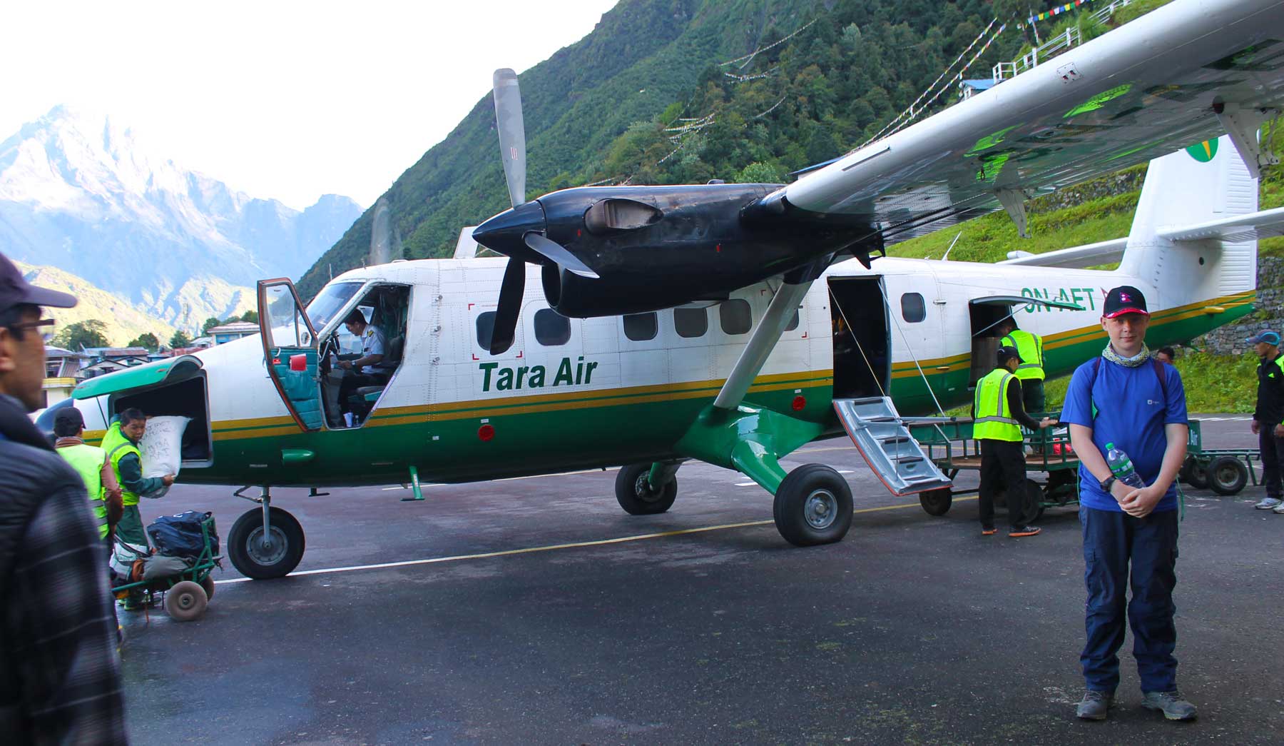
What generally happens with Nepali airlines is that one of them crashes, then changes its name or merges with another airline. Nonetheless, we booked through Yeti airlines and ended up on a Tara plane. At Kathmandu airport you board a bus and head to your plane. I remember seeing the dodgiest looking planes ever and thinking ‘I hope that’s not ours, I hope that’s not ours’, invariably the shadiest looking one, held together with little more than sweat and hope, was ours.
The tiny plane we boarded had just seven of us on there and was some cold war era looking thing that anywhere else in the world would probably now be in a museum somewhere. Thankfully we were told what side of the aircraft to sit on to ensure we got great views. Cockpit door clearly an affordable extra, the two pilots were waiting for a break in the cloud before they went for it. A slither of blue sky appeared, the engines roared to life and within minutes we were shaking into the sky and down the Kathmandu valley. Though only a 25 minute flight, I felt every single second. Convinced that any minute a screw would pop loose or a wing fall off. Conscious, that the most spectacular view I had ever witnessed, could well be the last thing I ever saw.
Eventually a tiny landing strip pops into view and the
mountains start to close in, moments later we landed on a ridiculously small
runway and held on, praying the plane would stop before hitting the mountain at
the end. Conscious that the flight has no option to ‘go around’. I have never
felt more grateful to any pilot. Well. Until the return trip.
Flying from Lukla to Kathmandu
By the time we had got back to Lukla, I would’ve boarded a paper plane out of there. That said, the flight back to Kathmandu is an experience in itself. Leaving Lukla is not something to be taken lightly, this is where delays are common place so arriving at Lukla airstrip we really didn’t know whether we would be leaving or not. We were told that the flight would be heavily delayed but that we had to wait on the airstrip for it to arrive. Eventually we saw a plane rocking as it came in to land, and here’s the best bit. As the plane was still moving people were bailing, jumping out and having their bags thrown at them. Suddenly someone jumps up and starts ushering us onto the plane, it was moving slowly but an urgency to get on, and get on quickly was made very clear to us. Literally we jumped on, with three other people and the plane did a quick U-turn and revved up down the runway. Looking out of the window I felt a sadness to be leaving Lukla then suddenly the plane dropped what felt like a long way, my heart was in my mouth. Turns out that because Lukla runway is on a slope, you literally go off the end of it and then become airborne. This is because when landing, the upward slope allows the plane to slow down quickly, but when leaving, get a much greater speed as it is going downhill. For everyone inside, and unaware, this results in fear of imminent expiration. For the aircraft, it is the only way for it to become airborne.
The flight back to Kathmandu was every bit as shaky and bumpy
as it was outbound and I just felt that every minute could be our last.
However, when we landed at Kathmandu and disembarked I looked at the pilots,
two men who are fair game for the buts of many jokes. Yet two men who fly
notoriously difficult routes, in one of the worlds least safe countries
aviation wise. Two amazing masters of their craft and clearly, outstanding
pilots.
Accomodation
Accomodation on the EBC
On the trail, accommodation is very basic. Most lodges are
shared bathrooms and some of the toilets are squat toilets. Nowhere has toilet
roll so bring your own. Rooms are small with two single beds, but in some villages,
there is very little choice and you can end up in a cramped wooden box with
little between you and the elements. Showers are chargeable and freezing cold.
It is expected that you eat your evening meal where you stay.
Supplies on the EBC
Water
We decided to take water purification tablets, and also to
take a ‘water to go’, which is a bottle that filters the water and claims to be
perfect for drinking water whilst out trekking. Given we would be drinking up
to 5 litres of water each per day, that is why we chose to take purification
tablets. Purely a money saving mechanism.
Cost of water on the trail 80NPR for 1L in Lukla, leaving
Lukla in Pahkding it costs 100NPR per litre and then increases in proce the
further on the trail you get, coming in at 250NPR per litre at Gorak Shep.
Food
Accommodation on the trail is crazy cheap, usually $1 – $2 per night, sometimes free, this is because it is expected that you eat your evening meal there. Meals range from veg fried rice or noodles, mo-mos, stews etc. Again, food prices increase depending on where you are on the trail from around 200NPR in Lukla, upwards of 600NPR in Gorak Shep.
Permits
If you are doing EBC independently you have to get your
permit from the Nepal Tourism Board in Kathmandu, not in Thamel. It’s not an
issue it’s an easy walk from Thamel or a short ride in a taxi.
Equipment list to take on the EBC Trek
Trousers x 3
Base layers x 3
Walking socks x 4
Softy/down/insulated jacket
Soft shell jacket (Windproof)
Waterproof layer (we used Gore-tex)
Buff
Cap and woolly hat
Blanket
Sunglasses
Gore-tex boots
Flip flops (believe me you NEED these!)
Gators
Walking poles
Map
Face wipes & Antibacterial gel
Sun cream
Toilet roll (no where on the trail has this!)
First aid kit (see here)
Water purification tablets/filtration bottle
Hydration tablets
Cheap phone
Camera
Note pad and pen
Book
Head light
Deodorant
Tooth brush and toothpaste
Note: Battery charging on the trek is often unavailable or you must pay for it. We didn’t take one, as my cheap phone had 30hrs of battery life, but worth the investment.
Day 1
Namche Bazaar with kids
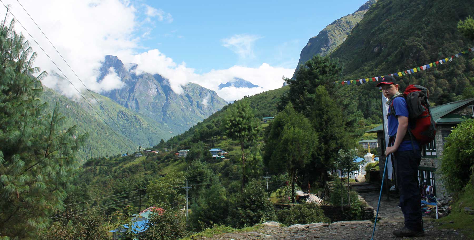
Lukla (2880m) – Namche Bazaar (3440m)
Distance: 25.8Km
Time taken:
9hrs
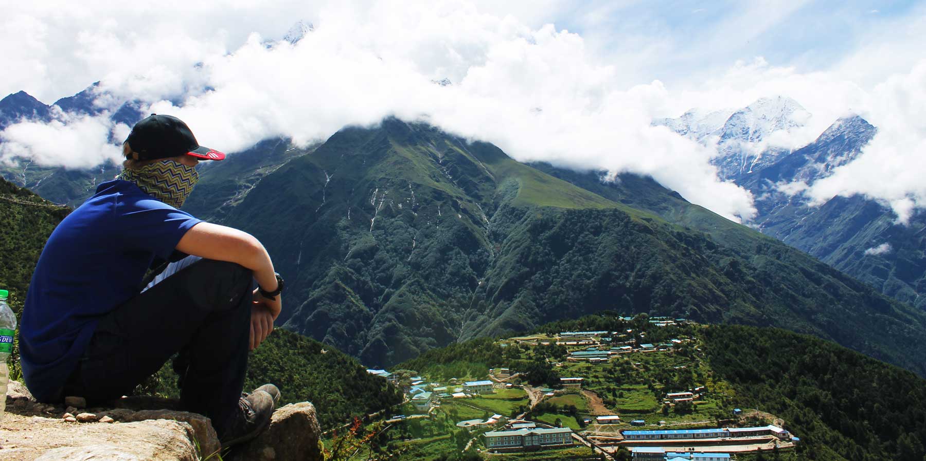
We landed into Lukla at 8.30am. For some reason every guide book recommends hiking to Pahkding, but to me this didn’t make sense. The elevation of Pahkding is 2610m compared with Lukla which is 2880m and it’s also not really that far. I decided it would make more sense to have a big first day and head straight to Namche Bazaar, feeling like we’d made some progress. It is so common that people hike just to Pahkding, that when we strolled up to the lodge in Namche Bazaar the guy couldn’t believe we had come straight from Lukla.
I would love to sit and talk about the village of Lukla, and
how this is great and that is great, but conscious of the hike ahead we
literally walked out of the airport, through the narrow streets of Lukla, past
lodges, trekking shops and straight to where we needed to register at a tourism
police check point. Effortless and slick, we registered and then left the
village through Pasang Lhamo Memorial Gate. Instantly, you are on a trail
headed into the valley meandering around the lush green mountain sides beneath
clouds clinging to the sides.
It is beautiful, you don’t need me to tell you that.
It feels as though you have been transported a world frequented by few, seen by even less, loved by everyone.
It is as close to paradise on earth. But it is subjective. We were there during monsoon season and I loved how the clouds teased us constantly, gifting a rare sight of a rugged peak just occasionally. I loved the green of the grass, the yellow of the flowers, the earth felt alive. Yet others prefer clear blue skies, tired grass giving a solid underfoot. That is why I won’t wax lyrical about the scenery, to me it was mind-blowing, to everyone something different.
We stopped for lunch in Bengcar, but this was really the only
time we stopped the whole day. Well except for when Charlie was doing a river
crossing and I realised we should have put gators on.
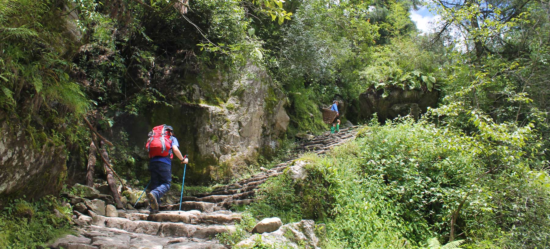
Between Lukla and Namche there are a total of six suspension
bridges. All six of them dodgy. Following the sixth bridge and easily the
scariest of them all, the incline increases and a tormenting climb of
switchbacks begin. They only end once you finally reach Namche and the end of a
gruelling day. Just before reaching the village you pass a check point, it is
also from this check point that you can buy certificates to prove to any
naysayer that you actually did the EBC. If proving people wrong just happens to
be your thing.
Charlie won the ‘you fell over first award’ about 2hrs into
the trek and he also won the ‘idiot of the trek award’ when a local child asked
him “what language do you speak”, Charlie responded, “thank you” and continued
walking.
From around 2.30pm we were rained on constantly, and this is
where having Gore-Tex was a life saver as we continued onwards in spite of the
weather. Once at Namche we were exhausted and found the first place we could,
ditched our gear and then sat in the amazing dining hall of the lodge reading
the stories and memorabilia of trekkers who had passed through here over the
years. Had it not been so cold I could’ve sat in there all night. As it
happened, we retreated to the room to read and within minutes Charlie had
fallen asleep and I was close thereafter. Both knowing that this had been one
of the most amazing, but hardest days of our lives.
Where we
stayed: Hotel Everest View
Costs: 200NPR
Calories
burned: 5433
Steps: 38,000
Day 2
Acclimatization day
Everest basecamp with a kid
Distance: 8km
Time taken:
2hrs 30 mins
At about 3000m the human body can no longer sustain itself
without proper acclimatisation and so people check out or get seriously ill. It
was also a great excuse to do nothing since we were still absolutely blown out
from the day previous.
In order to acclimitise effectively you are supposed to hike
somewhere higher in altitude than where you are sleeping, then retreat back. So
this is exactly what we did.
We headed up towards Khumjung hoping to catch our first
glimpse of Everest en route. This wasn’t to be, and we were a little
disappointed. We hiked to the highest point of the trail to Khumjung and could
see the village beneath us. Visibility was reducing quickly so we descended
back into Namche and played cards and read for the remainder of the day, and
our second night of little sleep due to dogs howling throughout the night.
Where we
stayed: Hotel Everest View
Costs: 200NPR
Calories: 1960
Steps: 11,838
Day 3
Namche Bazaar (3440m) – Pangboche (3985m)
Distance: 20.6km
Time taken:
7hrs
Leaving Namche is an immediate steep ascent, but this doesn’t
last long. The path levels out and becomes a gentle hike, not quite flat, but
termed to be ‘Nepali flat’ which means some ups and downs, but nothing major.
Once you reach Sanasa there is a long descent which we were
already dreading for the return journey and when you reach Phunki Thenga this
changes into a long, grinding sequence of switchbacks up to Tengboche. The
paths are mostly stoney and pebbled paths and it felt never-ending.
We originally planned to hike to Tengboche (3860m) but by the
time we reached there, it was midday and the place felt deserted. We decided to
have a bag of nuts for lunch and press on to Pangboche.
The stretch out of Tengboche is a steep descent through a
wooded area, the path is rocky and tough on tired feet. After a while you meet
up with the riverside and the path levels out, once over the bridge the climb
starts again and doesn’t finish until you reach the village of Pangboche.
It was another tough night, but thankfully dog free allowing
us to have a good nights sleep.
Where we
stayed: Gunbala Lodge
Costs: 100NPR
Calories: 3922
Steps: 30,251
Day 4
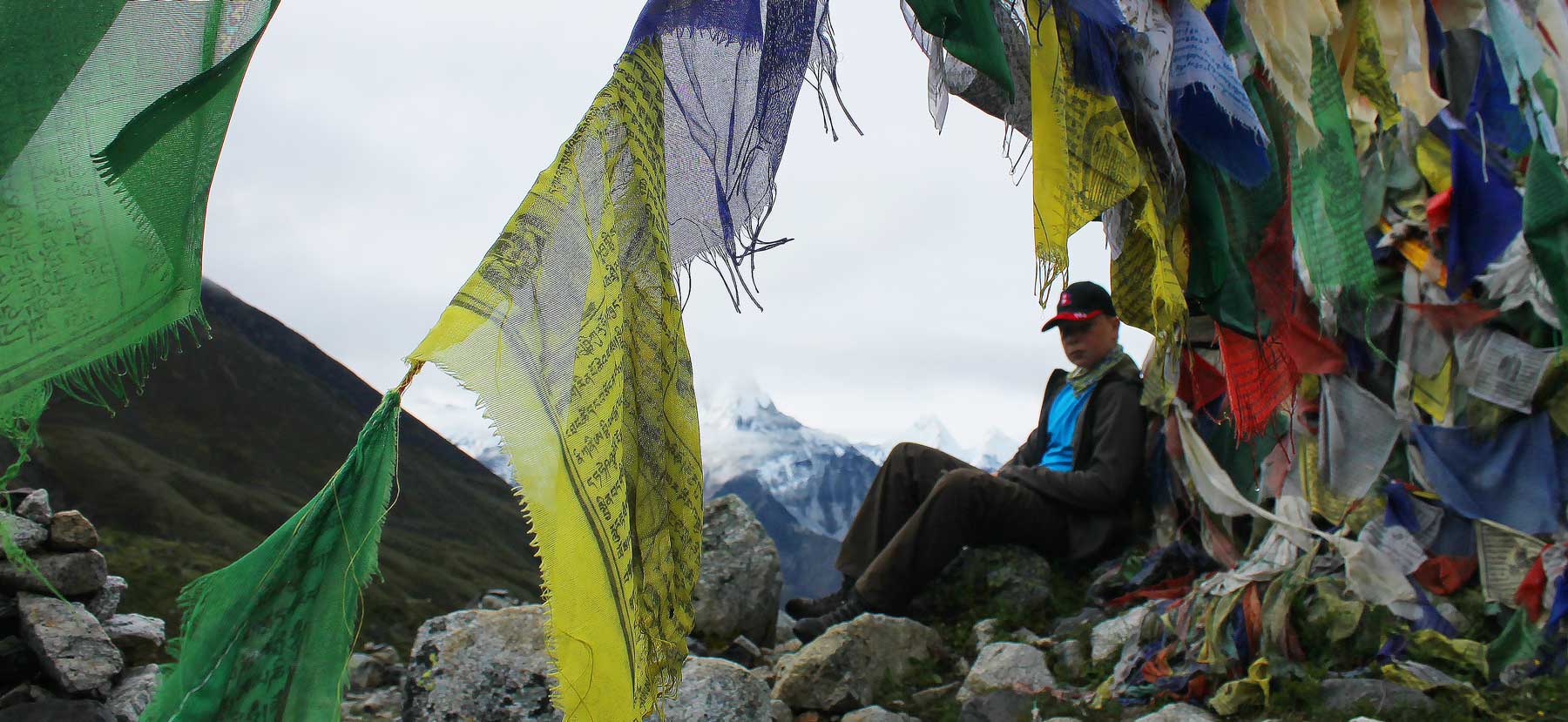
Prayer flags EBC Trek
Pangboche (2985m) – Thukla (4940m)
Distance: 13.5Km
Time taken:
4hrs
The plan was to head to Periche (4371m) and then see how we
felt and whether to stay over, or continue onwards. Again, we covered the
distance way quicker than we had expected and was in Periche after just two
hours, mainly due to the absolute ease of the hike. Since it was only 9.30am,
we decided to push on and head to Thukla.
Periche is a beautiful place in a stunning valley but felt
like it would’ve been a waste of a day to stay there. Upon leaving we were
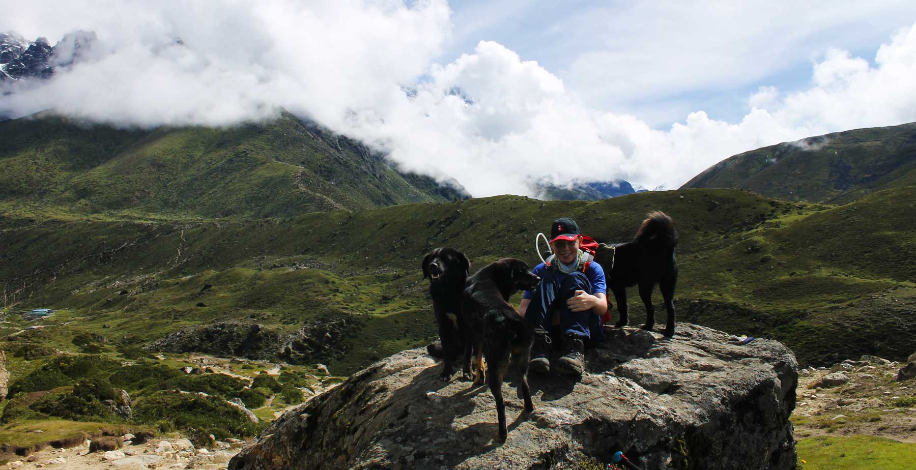
joined by a menacing looking number of dogs whose intentions we weren’t sure
about. It quickly became apparent they meant us no harm, and for a while it was
nice to be joined by them. Soon though they became irritating as they kept
pushing past us, squeezing between us and just randomly stopping in front of us
to the point they were significantly slowing us down.
The hike from Periche is sharp at times, but mainly a steady
incline. Both Charlie and I agreed that this was the hardest stretch so far,
not due to the terrain, but the altitude really started to get to us.
Eventually we saw a tiny collection of just two lodges and realised we were in
Thukla (also pronounced Thokla) and this would be where we would spend the
night. In order to access the lodges you must cross a super dodgy bridge Lara
Croft style.
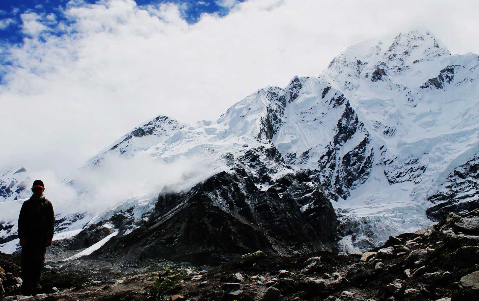
The ground now rocky and arid, devoid of life, greenery scarce, mountain peaks jutting into the sky, it was otherworldly.
For the first time we felt like we really were on top of the world. We were sandwiched between a glacier and a mountain, the cold air blasting us as it rolled from the peaks of some of the highest mountains in the world. The groaning noise of the glacier as it creaks added an eerie feel to what was already a lifechanging day.
The ascent was brutal. Breathing became harder, our bags felt
heavier, and we just pushed on knowing this was going to be the pinnacle, this
was why we were here.
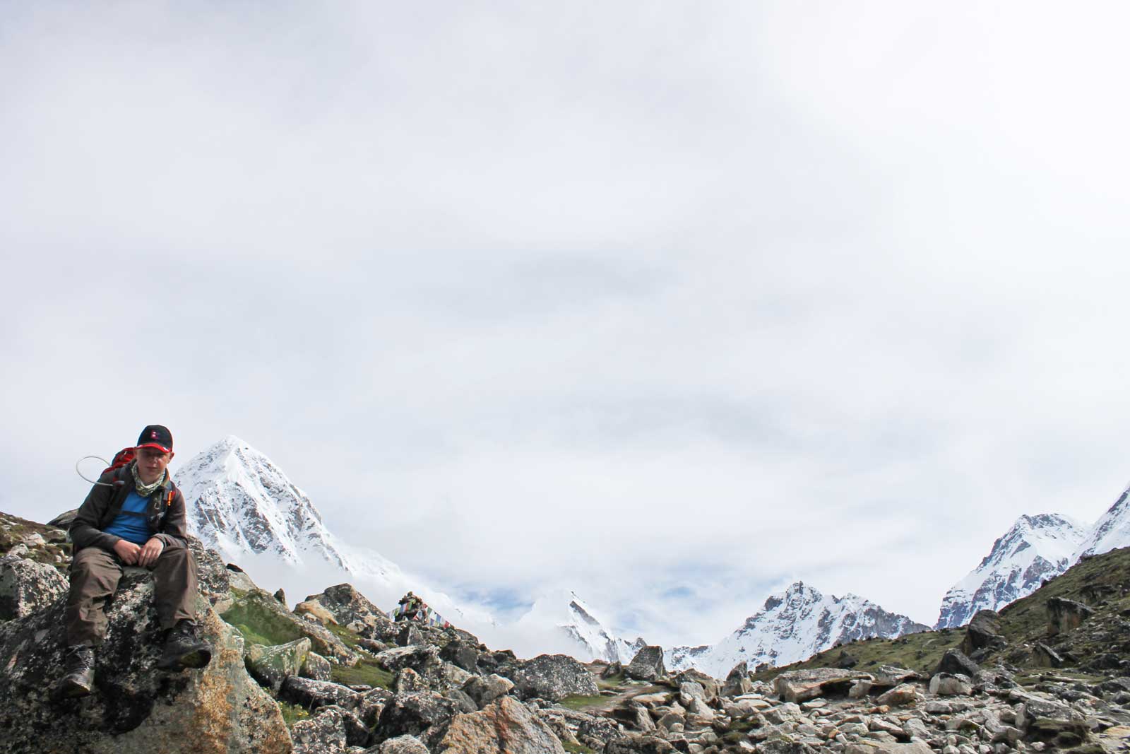
After what felt like an eternity we arrived at Gorak Shep, which really is the final frontier of the Everest region. Deciding we would spend the night here we ditched all our non essentials, refueled and continued on towards Everest Basecamp. Every step felt like the hardest step we had ever taken and when we got just past Kala Pattar speaking between us both was minimal. It had snowed the previous night meaning we couldn’t climb up Kala Pattar and so we continued following the glacier and sandy, rocky trail.
For the previous 2 days we had seen glimpses of mountain
peaks, we had witnessed and been privilege to a scenery I could never have
imagined. Yet we had still not seen Everest.
Our hike had now become a slow, desperate motion forward
taken with small steps as the altitude really gripped me. Charlie was better
than I was, but we both had headaches and were struggling to continue. And then
it happened. The clouds opened up like the curtains at a theatre. And we stood
there, waiting to see what the show had on offer and it was mesmerising. A tear
clung to my eye as my breathing shallowed, the hairs on my neck stood up. I
could hear the glacier grumbling away, prayer flags flapping in the wind. I
managed a weak motion of my hand over to Charlie and realised he too had found
himself in the same paradise that I had. For a moment nothing in the world
mattered. We had made it.
At basecamp I collapsed over a rock and knew we had to head
back. The journey back to Gorak Shep was silent. Both immersed in our thoughts,
grateful for seeing earth at its rawest, and most rugged. For me it was the end
of a journey that I had trained for, worked hard for, and that if I am honest,
didn’t think I would achieve. Charlie at just 14 years old knew that he had
instantly become one of the elite, one of the few children to have ever stepped
foot at basecamp.
Though we saw Mount Everest, the summit remained hidden from
view behind a linger of cloud. Perhaps coaxing us back to see if we might one
day see the roof of the world in its raw glory. Who knows. But back at Gorek
Shep I was now feeling really ill so we retreated to bed and slept off the most
difficult, but amazing day of our lives.
Where we
stayed: Snowland Inn
Costs: Free
(assuming you ate at the restaurant)
Calories: 4,158
Steps: 26,450
Everest basecamp with a child
Day 6
Gorak Shep (5164m) – Debuche (3734m)
Distance: 25.5Km
Time taken: 6hrs
We had planned to hike all the way to Tengboche, we had to
descend. We had hung around all morning at Gorak Shep hoping the clouds would
clear fully and I was now really struggling with altitude.
Hiking out of Gorak Shep we immediately started to lose
altitude and it really is amazing how quickly I started to improve. The talking
between us both started back up, and a new energy was there. Due to the late
start, and knowing you aren’t allowed to trek after sunset in the region, when
we arrived into Debuche we decided to spend the night. A guide told us that the
next village, Tengboche was closed. I have no idea of this was true, but it no
longer mattered.
Speaking to Charlie that night it became apparent how well he
had masked his struggles at basecamp. To me he looked ok, but he explained how
physically demanding the day had been but how he knew I had been struggling and
didn’t want to give me anything else to think about. And really that sums him
up, tenacious, caring, determined and someone who is a fantastic hiking
partner. I realised just how proud of him I really was at that point.
Where we
stayed: Paradise Lodge
Costs: 250NPR
Calories: 4,202
Steps: 37,394
Everest basecamp with teenager
Day 7
Debuche (3734m) – Lukla (2880m)
Distance: 35.4km
Time taken: 10Hrs
Leaving Debuche and headed to Namche Bazaar I realised how
physically and mentally tired we both were. We hadn’t showered in a week,
opting rather for cold washes and roll on deodorant. We hadn’t had a good
nights sleep, hadn’t relaxed, and I wanted nothing more than an ice cold soft
drink by a pool to relax what was now my aching bones. I had an idea.
I said to Charlie, that if we hiked the unthinkable, all the way back to Lukla, then we could fly out of there hopefully in the morning.
I would get us a 5-star hotel in Kathmandu, eat at the best restaurant and spend a couple of days doing absolutely nothing. He was sold, and we pushed ourselves beyond our limits, hiking the entire way back to Lukla.
There comes a time when you are hiking that you are no longer
tired, where your legs feel so heavy that their movement becomes autonomous.
Where if you blink longer than a split second you would fall asleep. Hiking
into Lukla, in darkness. That is how we felt.
Where we
stayed: Lama Hotel
Costs: 150NPR
Calories: 5704
Steps: 51,915
At the airport the following morning, looking out over where we had started. Where an adventure that had pushed us both beyond our limits was now over, we hugged. And we shared a silent moment of perfection, of understanding, of pride and of the realisation that we had shared something so beautiful, something so amazing that we could never share just how spectacular the last seven days had been, and just how life changing it was.
Singapore or Malaysia? Two world class places just a 45 minute flight away or 6hr VIP bus ride, KL is a city, and Singapore a country with the feel of a city. Most backpackers will find themselves in one or both cities and probably, this will be due to the budget airline they are using to fly around the region. Home to Air Asia, KL is the global hub for a zillion flights around SE Asia, if you find yourself on Tiger/Scoot or Jetstar then you will end up in Singapore. In terms of what to do, and where to be, which is the best? Singapore or Kuala Lumpur…
Best is obviously subjective, and there’s a lot to consider. I will break down both cities in respective categories and then conclude. Agree or disagree? Let me know.
Cost
Hands down KL is cheaper than Singapore on every level imaginable. Now that Grab is firmly established you can zip around the city for a few quid, a half hour journey will set you back around a fiver. Singapore does not even come close, taxis are still cheaper than the west, but are painfully expensive by SE Asia standards.
Food, travel, accommodation and entrance to things are all cheaper in KL. One thing to be aware of though is that KL operates in many places a two tier payment system whereby tourists pay more than locals. It’s an absolute scam and really the theme of Malaysia in that generally, a Malaysian will be more than willing to screw you for a few ringgit whereas in Singapore scams are rare and Singaporeans pride themselves on their honesty.
Still, accommodation within KL can range from as little as 90MYR (£16) for a half decent double room, but will start at least double that in Singapore. Consider standards too, rock bottom places in Singapore have rock bottom standards.
Getting around both cities on public transport is cheap, efficient and easy thanks to world class transit systems.
Things to do
Both Singapore and KL offer a lot for the tourist. Singapore is classier with mega resorts, universal studios and Sentosa Island. KL serves up culture well by way of Batu Caves and is home to sunway lagoon, a multi themed park with just £25 entrance. If fun is your thing then Singapore edges it, but falls short when it comes to culture, though it does serve up old colonial history well. KL also has an overpriced zoo, whereas Singapore has the best zoo in the world. Cinemas in KL cost about a third of watching the same movie in Singapore.
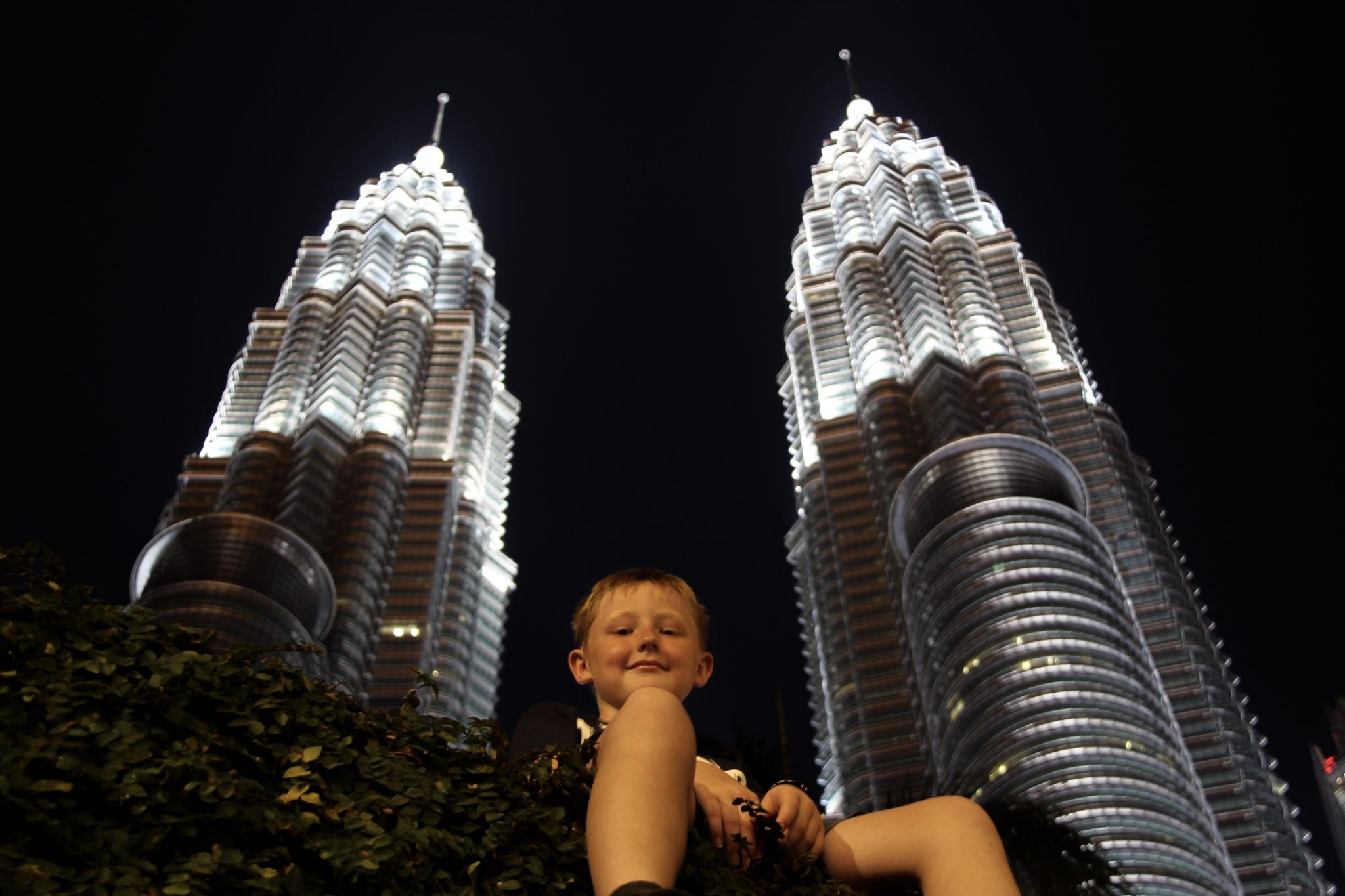
Both cities can be walked, and KL is particularly lovely in KLCC park which gives great views of the Petronas towers and offers a pool and huge play area for kids to burn off energy.
In Singapore, head to the Marina for great city views and a good walk around the area.
Considering both are jumping off places for the region, my own preference is Singapore, but don’t let that detract. KL is still a great place to find yourself.
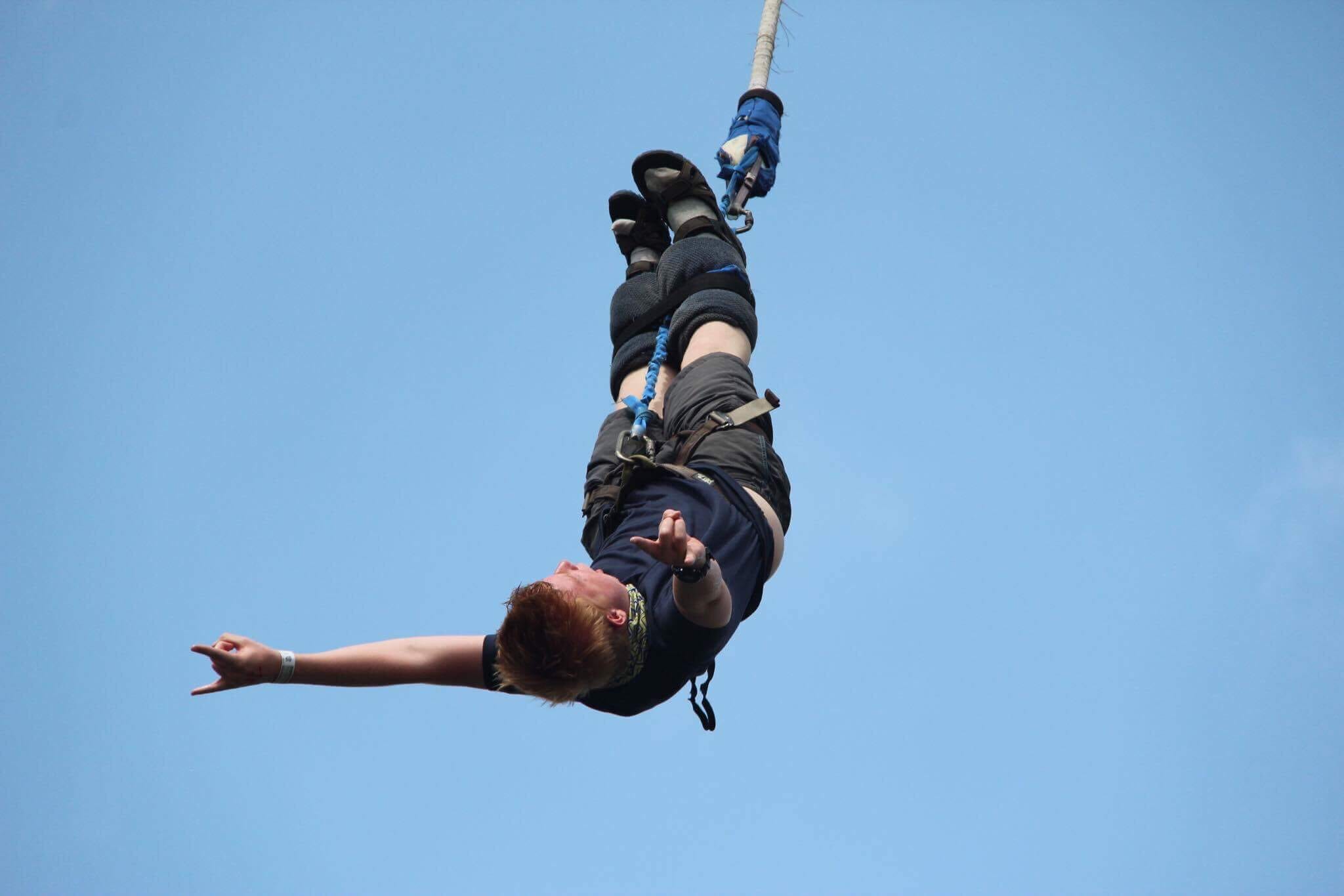
Bungee Jumping Sunway Lagoon
Shopping
Most backpackers finding themselves in either place will want to dust off SE Asia and maybe go shopping. KL has lots of malls, none as classy as Singapore. That said, you can still grab a fantastic bargain in Singapore, if you are looking for cheap tat Bugis is the place to go.
KL is where you can get fake watches, handbags and everything going. Singapore is where you can shop Gucci and Versace and not have to consider authenticity. KL is by far the better place for a bargain and no where is better than Times Sq, a huge mall dedicated to getting pretty much anything you want, as long as it is counterfeit. If you want that little bit of culture, the Bukit Bintang is where you should head.
Safety
Kuala Lumpur is one of the most dangerous cities in SE Asia, whereas Singapore is widely regarded as being the safest country in the world. It is blatant to see too.
Malaysians generally are good, honest people, but there is a large number who are greedy, deceitful and will scam your last breath and then kick you for more.
Taxi drivers are particularly aggressive, I suggest you stick to using Grab rather than have to go through negotiations at transport stations.
Singapore has tough laws and as a result is far safer. Even in the early hours, you just get a sense of belonging, of complete safety throughout the city. Singapore does have its seedy sides, particularly along Orchid road and in parts of China town and Little India.
Food
If you want Western food, then Singapore is your place. If you want cultural delicacies then again Singapore is your place, but you’ll pay for it. Malaysian cuisine is nice, but chicken comes on the bone and is often suspicious. Not in the sense that eating a chicken leg in Cambodia will have you bolting for the bathroom, but in the sense that no flair or pride is taken in food in Malaysia. In Singapore food is safe, always. It is also served up usually by someone that actually cares whether you like it or not. I just get the sense that in KL food is just one of those things you do because it’s a necessity.
Service in Malaysia is notoriously bad. If you order a meal at a restaurant and you actually get what you ordered then put the lottery on, today is your lucky day. Thanks to a combination of laziness, contempt for seemingly everyone and the fact that Malaysians rarely look up from their phone screens you will wait ages for your order and then have it served up wrong. Singapore is slick, fast and world class in the service respect. If you flew to SE Asia on Singapore airlines then you will already know that.
People
I love culture and diversity and as a result, Singapore wins hands down. A nation of hardworking individuals, Singaporeans are world leaders in just about everything they turn their hands to. Malaysians on the other hand are world renowned for being lazy and nondescript. Walk around either place and you will see young Malaysians rarely looking up from their phone, completely indulged in a virtual life. The older generation of Malaysians are a class apart, hardworking, amazing people. Join a queue in Singapore and relax, join one in KL and wait for someone to slyly try and edge their way ahead of you. Go to a store and need serving, that’s fine. As long as the Malaysian serving isn’t busy chatting to a friend or texting on their phone. There is a real streak of contempt for foreigners, a real disdain among Malaysians for pretty much everyone. Singapore on the other hand feels like home, like the most welcoming place in the region. Read Malaysia hates foreigners for more.
Conclusion
It probably reads like I prefer Singapore over KL and generally I do. It is cleaner, safer, slicker and just a better place to be. Singapore is world class and few people leave not liking what they have seen and felt. KL on the other hand is like marmite, some people love it, some people hate it. Personally I have a real soft spot for KL, excellent prices and a real ease of connecting throughout the region both on air and land make it a genuine magnet for backpackers looking for a stopover. To say one is better than the other, then it would have to be Singapore for the many reasons that I have stated above. I do however think both places should be visited. KL is a great stop over mid trip through SE Asia, a great place to remind yourself you’re Western and to spend a few days relaxing. Singapore on the other hand makes the perfect end to a trip, a great place to grab a good shower, food that is safe and tasty and somewhere to pull up a quilt, put on some English speaking TV on a flatscreen and relax knowing that even if for a short period, you are back where you started.
If you can only visit one place, then Singapore is the obvious choice if you have money. If not, then head to KL but keep a keen eye on your wallet.