
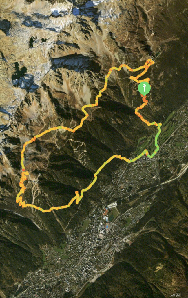
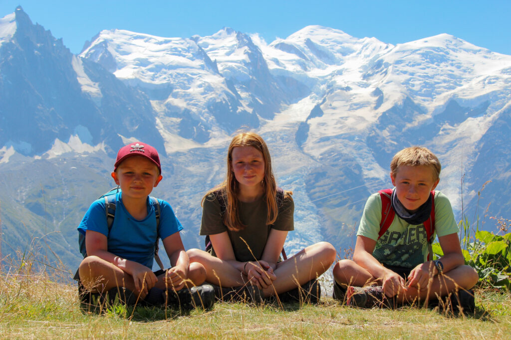
Grand Balcon Sud circuit, Chamonix
The Grand Balcon Sud is renowned as being one of Europes greatest day hikes, offering up sublime views of the Mont Blanc massif. Most routes show this as a one way hike making use of the cable cars. That is not required as the hike can be completed as a circuit offering up stunning woodlands, ravines, rocky paths, rivers and at most times, one of the continents most phenomenal backdrops.
Start: La Flégère, Chamonix
End: La Flégère, Chamonix
Distance: 18km
Time: 5 – 7hrs
Elevation gain: 1102m
Difficulty: Moderate (Easy after first part of hike)
The route and hike I write about here is one that has been devised partially by myself, but probably exists somewhere. The Grand Balcon Sud is a panoramic hike that traverses between two cable cars, ‘La Flégère’ and ‘Planpraz’. This hike takes a couple of hours and is 6.0km. The issue with this, is that it isn’t a circuit (though buses do run in Chamonix between the two, or it is a 3km walk). And that also, the cable cars cost about 18 Eur each way Which if you are a family of 5 as we were, costs a small fortune. Additionally, I love a good circuit so came up with a route that takes in the Grand Balcon Sud, but avoids using the cable cars.
Parking is free and plentiful in the area around the chair lift. There is also parking at the golf course and lots of on street parking nearby, all free.
Start: La Flégère, Chamonix
The first portion of the hike requires walking through the golf course also signed as ‘Paradis Les Praz’. Once at the end of the car park follow the river for 50m, then cross the river and pass the toilet walking up into the tree line. From this point on you should follow the signs for ‘ la Flégère’.
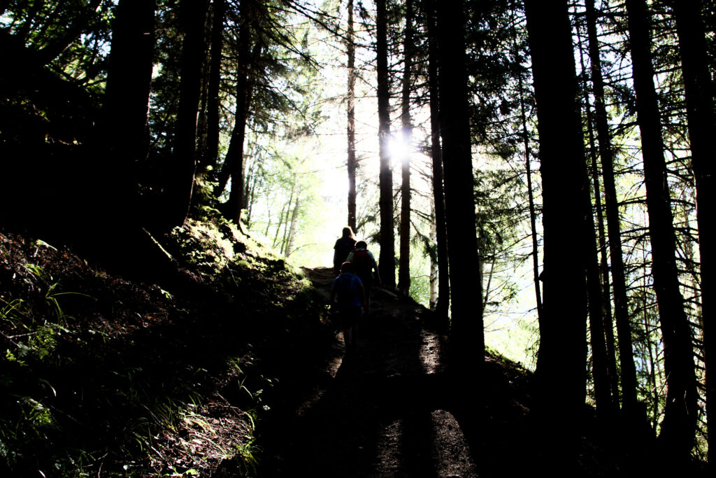
The next 3km are a punishing, repetition of grinding switchbacks that meander steeply up the mountain. We started the hike at 7am on an August day with temperatures lingering around the low 20C as we began, but climbed quickly to a high of 34C later in the day. The shade of the trees was a welcome respite from the brutal sun that blasts the length of the mountain all day.
The path winds up through the alpine trees, the beauty of the this circuit is that the vast majority of elevation is covered here.
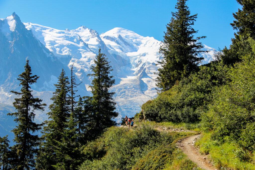
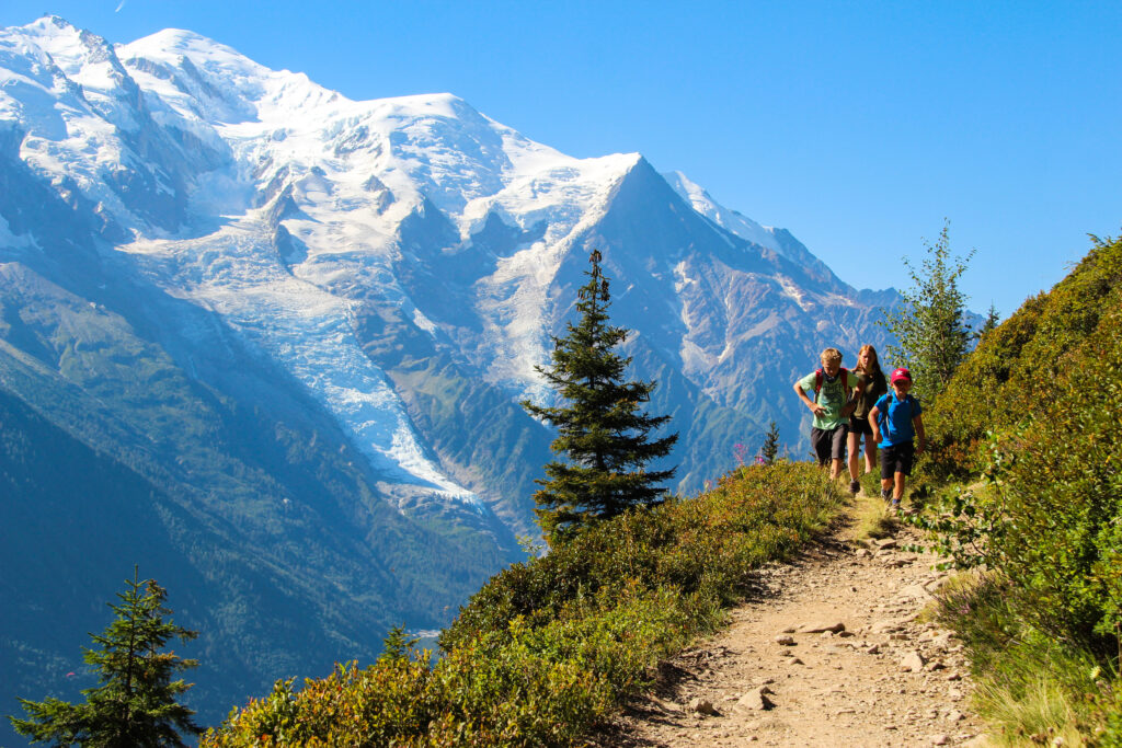
It took us 1hr 45mins to reach la Flégère and we had hiked 800m of elevation. Looking out over Mont Blanc was every bit as spectacular as I could have have imagined. The snow capped mountains paint the skyline a stunning mix of rock, snow and absolute beauty. You can hike even higher than la Flégère mid stop, covering another 600m of elevation and I did consider it. But for me, I wanted to feel the magnificence of the Mont Blanc massif which was by now about 2500m higher than us, I knew that in photographs it would still have the behemoth effect that would be reduced the higher you went.
You must now follow signs for ‘PlanPraz’, which begins below the cable car the lower left and in the direction of Mont Blanc. The hike itself traverses the side of the mountain, crossing rivers, meandering through woods and for the most part, offering up stunning views of the Mont Blanc massif.
The path is easy to follow and moderately busy, there is a total elevation gain on this route of just over 300m.
There are several opportunities for little side hikes along the route including some via ferrata, the famous La du Brevent, and the Brevent summit itself. I was hiking with an 8 year old on a brutally hot day, but if I didn’t have kids in tow, I would have followed the signs for ‘Via des Evettes’ after about 1.5km which would take you up to the wire bridges. I would then have walked along the ridge across the tops of the mountains and then descended from Brevent summit down to ‘PlanPraz’. All the while the Mont Blanc massif would have been the perfect backdrop.
It took us about 2 hours to reach PlanPraz, with the last leg of the hike taking the longest as this is now a single track hugging the hillside, that was quite busy making passing people awkward. When the path does open up, we arrived at PlanPraz for lunch and probably the best views of Mont Blanc anywhere around Chamonix.
From PlanPraz there are clear signposts of the path that descends back into Chamonix. Follow this as it hammers your knees for about 1000m of descent. If you have a map (or google maps), I had 4G signal for most of the route, then you can follow the paths right back through the woods to La Flégère, Chamonix. All paths eventually lead to Chamonix if you are headed downwards so even if you get lost you will at least be in Chamonix where La Flégère is well signposted, or wherever you chose to park.
This is without a doubt, on a clear day probably not only the best hike in France, but the best hike in Europe. Avoiding the cable cars makes this hike completely free, and the accomplishment of completing the circuit makes it worth every drop of sweat dripped on those switchbacks.
Enjoy.


Comments are closed.