Categories
North America

Alabama

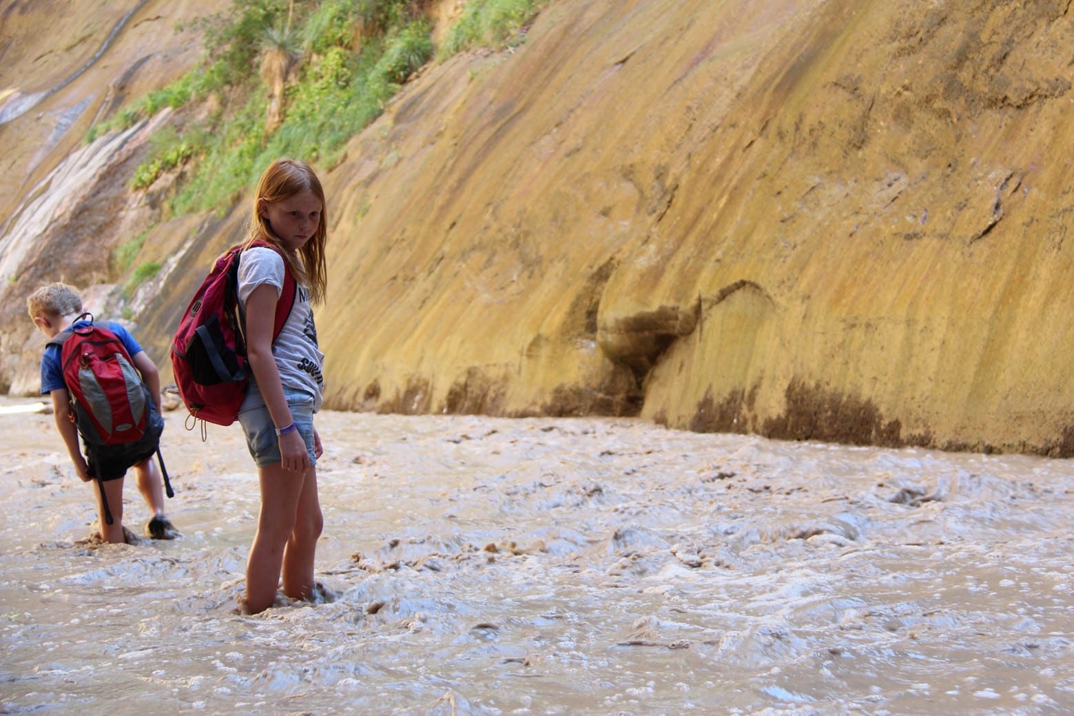
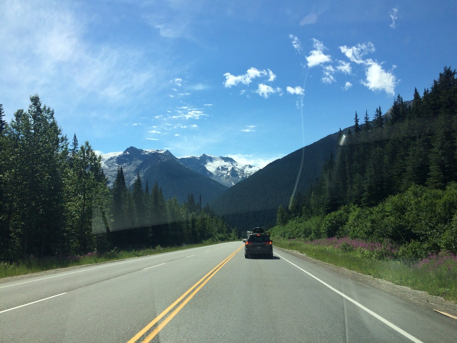
Alabama is a hard state to like. No doubt about it, it is not only struggling to free itself from decades of troubles but also from a generation that is as ignorant as it is aggressive. For the first time anywhere in the States we met racism first hand, deceit, aggression and an uneasy feeling that swept our days to the point we literally could not wait to leave. And when we did leave, normality resumed.

Our first stop was Montgomery, State capitol and part of one of the most significant events in the civil rights battle of the 1960’s.

Alabama

Nestled in the deep south of the United States, Alabama is portrayed as being a tormented state with a tumultuous history of violence, murders and a struggle for equality. Researching the past of this tortured state serves up an incredibly sad tale of an unnecessary struggle that goes against everything humanity stands for. What makes this worse is that this happened not centuries ago, but in the 1960’s. What adds to the incredibility of the whole situation is that the events took place in the Bible belt. A slice of America that lives their lives according to the gospel, that ancient book that preaches equality and kindness and love for all mankind. There must have been an excerpt that I missed in Sunday school that said it applied to everyone that wasn’t black.

I cannot possibly do the civil rights movement justice in a blog post, and I will not even try. But a little history is significant to why we were there, please read this post with an understanding that the Civil Rights movement requires volumes of publications and I urge you to go and read about the struggle. It is as fascinating, as unbelievable as drenched with absolute sorrow and pity. I am going to write the remainder of this post without emotive verbose, but in a way that presents a succinct history that encompasses the belief that everyone should be treated equally.

Civil Rights Movement

Emmet Till was a 14 year old African-American boy who through a series of almost unbelievable circumstances in which he was accused of flirting with a white woman, wound up murdered in the summer of 1955.

African-Americans in the United States had been persecuted and segregated for decades and murders were nothing new. But the brutality of Tills murder shook the community to the core. He had suffered the horrific injury of having an eye gouged out, was beaten almost to death, strangled with barbed wire and then finished off with a bullet to the head. His mutilated and broken was body was dumped in a river.

Tills mother opted for an open casket for her son to show the nation the tragic and brutal end her son had met. Suddenly the community united and began to stand up in numbers for the rights of black Americans. Just 3 months after Tills murder, Rosa Parks famously refused to give up her seat for a white person on a bus in Birmingham. She was duly arrested and ultimately the Montgomery bus boycott began. For over a year Black-Americans in Montgomery refused to catch city buses, instead forcing themselves to walk everywhere. Similar boycotts sprung up around the south and resentment grew amongst white Americans.

For years crusaders such as Malcolm X had expressed frustration and incited protests which often turned violent. Many groups had sprung up fighting for equality and one such man was Martin Luther King. What separated King was not just his innate ability to captivate with his speeches, but his non-violent stance bolstered by his belief in the Lord. Many of Kings speeches are now notorious for being some of the best words ever spoken in support of freedom. Ultimately winning the Nobel Peace Prize, King gained hundreds of thousands of supporters.

In 1965 King received a letter from the Student Nonviolent Coordinating Committee requesting that he come to Selma to aid the struggle for equality in voting. Though Black Americans were allowed to vote, they had to first pass an impossible system of registration which required them to answer questions which were impossible to answer. King responded and non violent demonstrations took place in Selma outside Dallas County courthouse, state troopers used violence to disperse the protesters and ultimately protester Jimmy Lee Jackson was shot dead.

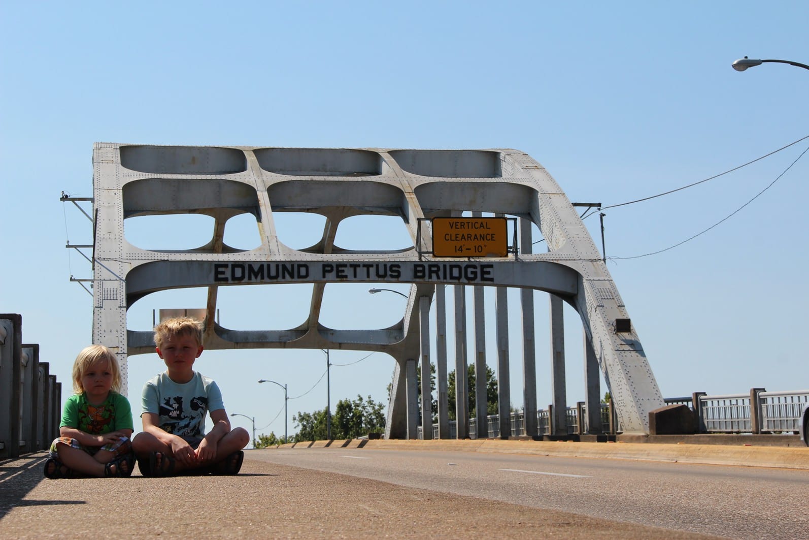
Following the murder, King and the SNCC decided to march from Selma to the State Capitol to speak to the governor. It was Sunday, March 7th 1965 and the march had gained a lot of interest from newscasters. With cameras rolling, the world watched protestors led by King, cross the Edmund Pettus Bridge out of Selma. What happened next would send horror throughout not just the south, but the whole world. Protestors were beaten, kicked, stamped on and over fifty were hospitalized. Americans outside the south had for the first time been exposed to the struggle of Black Americans. Support rolled in from all corners of the nation and pressure on the president to act was increased. King had planned another march to be held on March 21st 1965 and called on anyone that supported the path to equality to attend. The Alabama governer was defiant and ordered his state troopers to again intervene. As a result the President federalized the police taking them out of State control and allowing the march to proceed. Over 4 days the marches walked in brutal heat, young and old to the State Capitol in Montgomery.

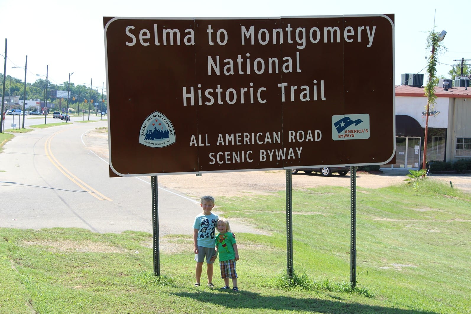
As a result of the Selma to Montgomery marches Black-Americans had voting restrictions lifted and were finally given the same rights as their fellow country men and women.

Martin Luther King was assassinated on April 4th 1968 in Memphis, and following his death riots erupted across the United States. A movement had lost its voice.

Fast forward to 2015 and the civil rights movement is not just a touching piece of American History, but a fascinating insight into the struggle of man in what can barely be classed as history. People from that era are still alive today, and that is what makes it more amazing, that all this tragic history happened within some peoples lifetimes.

A visit to Montgomery is to not just witness significant pieces of history, such as the exact spot where Rosa Parks refused to give up her seat, but is also a showcase for the civil war which tore through the south in the 1700’s. America lacks history, but it seems in Montgomery every corner houses a slither of a bygone past such as the State Capitol, or Jefferson’s house, the Rosa parks museum and Union Station. The city proper is easily walkable and though incredibly humid is an amazing peek into a tumultuous history which defined a nation, more than once.

Two parts of Selma have now been designated national parks, one is halfway along the now famous Selma-Montgomery route and serves up (for free) an interesting look into the civil rights movement. Along the same route are four different camp sites where the marches stayed. In Selma itself is a sister NPS museum at the Selma side of the Edmund Pettus Bridge. There is another museum but it costs $8 entrance and the woman that worked there assured me it was the only museum in the area. She was lying. Just cross the bridge and look on the adjacent corner.

Selma retains a lot of character and feels distinctly southern, it is almost unbelievable that as we stood on the bridge that sparked a movement which changed history we watch turtles swimming in the river beneath us. It was so peaceful it was impossible to imagine the significance of where we were. It is only really after leaving, after visiting the museums and reading of the struggles, after visiting the civil rights memorial in Montgomery where the murders of innocent Black-Americans are detailed – That you really start to feel a powerful emotion of the capabilities of other humans. Even now, sometime later, to think that people were treated differently and ultimately murdered due to the colour of their skin. I will never understand that.

We visited many places in Alabama related to the civil rights movement and even found ourselves tracing the Civil War, stopping off at museums and battlefields and really, it should’ve been the perfect tour through history. But from first arriving in the State to leaving we were treated with absolute contempt from every person we dealt with. Even in food outlets we were barked at, ignored, berated and met the worst customer service that I personally have ever experienced anywhere on earth. It is difficult to put into words, but I really felt like Alabama was highly unfriendly, and hated us. It was a real shame as it is such an amazing place in so many ways, but when every time you get food, fuel, drinks etc. you are met with absolute contempt it soon starts to grate. We felt threatened and aggression seemed forever present to the point we felt unsafe at various points during our trip. When we called at our last stop in Alabama; Huntsville Space Centre, we all agreed that we would never, ever return to Alabama.

Please note – Home Towne Suites

Heading to check in to our hotel ‘Home Towne Suits Montgomery’ I was met with a black girl (this is relevant) who stated that there was a shift change and that I had to wait 20 minutes. I sat down and began to wait, literally 2 or 3 minutes later a black man walked in and the same girl checked him in. I was absolutely stunned. She then instantly disappeared and I was forced to wait about 20 minutes. Upon getting to the room there was no crockery or bedding for the sofa bed. When I approached the front desk I was hissed at, eyes were rolled and eventually the woman even shouted at me. It was like nothing I had ever experienced and a sign of what was to come in Alabama. I have to just add, I was absolutely annihilated by bed bugs, kept awake with raucous 4am parties by the pool and when we rocked up for the free breakfast it didn’t exist. We hated the place and when we went to get a refund and leave was met with a sign saying ‘NO REFUNDS’. It was no surprise. Over a million people have used this blog, Booking.com is censored, TripAdvisor too – Remember the name – Home Towne Suites – A racist hotel riddled with bed bugs and aggression – AVOID.

Categories
North America

The Narrows, Zion NP

The Narrows hike in Zion National Park is the crème de le crème of hikes in Utah, it might not be the most spectacular, offer the best vistas or indeed hold anywhere near the same adrenaline rush of precariously stepping out onto Angels Landing after a torturous number of switch backs. But what the Narrows does offer, is a somewhat unique, highly fun and beautifully brilliant hike that requires little effort and is as long, or short as you intend it to be. People flock from all corners of the world to step into the Virgin river and hike between the narrow canyon walls, around corners where every turn offers up a different view, often a different footing, usually a different depth. Without doubt, hiking the Narrows is one of the best hikes we have ever done and is a firm favourite with both Jack and Abi.

Trailhead: Riverside walk (Temple of Sinawava stop)

Trail End: Riverside walk – Or further up river if you have permits

Distance: 2 mile roundtrip from Temple of Sinawava minimum, then as far as you like thereafter (maximum 9 miles in the river)

Time: Minimum 1hr, maximum, who knows

Difficulty: Easy, if hiking only a couple of hours

Introduction


There are essentially two ways you can attack the Narrows. The first is starting way up river, for this you need a permit and must pre arrange expensive transport transfers. The second, and easily the most common way is as follows:

The Narrows hike is not just the most popular hike in Zion, it is one of the most popular hikes in the United States. Its accessibility, fun factor and uniqueness make it a magnet for anyone looking for a bit of outdoor adventure. Unless you turn up ridiculously early you will be sharing the virgin river with hundreds of others. But don’t let this distract you, for at every turn people are weeded out and eventually (for us it was 1 hour) you are amongst an enthusiastic few that shared the same curiosity of what the next turn held.

Private vehicles are not allowed up the Zion Valley and so you will either hit lucky and find a spot in the visitor centre as we did, though it was Saturday morning and 90% full at 9.30am, or you can park in numerous other places in Zion village. A bus shuttle runs up the valley every 15 minutes, and you should board this and get off at the very last stop; Temple of Sinawava, named such due to the open area nearby resembling an amphitheater. It really doesn’t and I am convinced they had simply run out of names. The journey from the visitor centre takes about 30 minutes, but is scheduled at 45 minutes.

To begin the Narrows hike you must first of all hike the 1 mile along the easy, and paved riverside walk. This in itself is a nice walk populated by friendly squirrels daring you with their cute eyes to risk being fined $100 to feed them. Walk past al the idiots wearing shoes, denim and even wellies (usually Chinese) and make your way to the natural end of the walk, and place you enter the river.

The visitor centre screws hikers $25 to rent canyon shoes, and you can also rent a stick. Now, someone is seriously laughing all the way to the bank. First of all trainers/sneakers/runners, really. We did the hike in sandals, who pays $25 for a pair of shoes that are going to get soaked instantly? And sticks, you walk through woods to get to the river, there are a billion sticks! Unless you are hard to the core and plan on hiking for miles, just don’t bother.

You cant miss where you enter the river, and technicaly you can entre it at a number of places before. But wherever you enter it, you wont fail to be surprised at how cold the water is, and how murky it is. You may have seen photos online showing a crystal clear river with people hiking along all smiling, chatting and seemingly knowing each other – They are fake. The reality is, the water is a sand brown, freezing cold and everyone is on their own personal mission to stay upright. Almost instantly Jack fell into the river, the current was a little strong for him and due to his miniature size he was literally wiped out. For an adult though its more a case of balancing and not unknowingly stepping on a dodgy rock designed by you’ve been framed.

It is quite beautiful, despite the amount of people in the river, the canyon walls are extremely high and even just 50m past the starting point are no more than 20m wide. The kids absolutely loved every second of what we were doing, and we hiked for at least 2 hours up river. After the first hour the other hikers were somewhat thinned out and from an over populated photograph early on, we had empty stretches and canyon walls which seemed to go up to infinity. The thrill factor kept driving us on and though Jack had water up to his arm pits, they never went higher than my waistline. It was an absolute privilege and we genuinely loved every second. It ranks in my own top 3 hikes in the world, and tops the lists of both Abi and Jack.

I think if we ever returned to Zion I would get the permit and do the full hike, though it was amazing it was hugely popular and I just wonder how much more spectacular it would be having the place pretty much to yourself for miles and miles… I have to return.


Categories
North America

Arches National Park & Dead Horse Point

Just 4 miles north of Moab in Eastern Utah, Arches National park has been attracting visitors to its bizarre, and often unfathomable rock formations for a century. The geology of the park is boring, I could sit and reel off how the arches were created and how the freaky rock structures were formed and you would give up on this post. It’s probably best just to say they are the result of erosion, and gorgeous to look at. With that in mind I will shoot straight forward to the hike.

Delicate Arch Hike

Trail Head: Wolfe Ranch

Trail End: Wolfe Ranch

Distance: 3 mile round trip

Time taken: 2 hours, including 30 min relaxing at the arch

It is of course important that I first of all point out that this hike is completely exposed and that temperatures on the trail regularly exceed 100 degrees F (38C) in the summer months. Hikes should be started early in the day and preferably concluded by 10am. Water is a necessity, with the national park advising a minimum of 1 litre per person.

To get to the trail-head simply drive on through Arches NP and look for the delicate arch turn off. Less than a mile down this road you will see a car park, there is supposed to b e a sign for Wolfe Creek but I didn’t see it. We arrived at 7.30am and the car park was about half full, and when we finished by around 9.30am it was about 2/3 full.

The hike begins on a paved trail, crosses an iron bridge and immediately forks to some petroglyphs, though tiny, they are worth the five minute detour. From there it is a gradual uphill still on paved trail until you reach a large rock which takes up the entire landscape. In good weather you can see in the distance the direction of where you must go. In poor visibility, or darkness there are cairns placed on the trail, keep these to your left as you hike up. Occasionally the ground becomes sand, but generally it is good ground. The kids and I paved our own way as I saw some great photo opportunities, I would not recommend this at night as there are some steep drop offs that though won’t kill you, may injure you.

I was powering up the hike, and within no time we were all sweating, the kids complained it was a bit difficult but it is perfect gradient for getting the blood flowing. I would say the hike in terms of difficulty is probably a 2/10 – Combined with my speed, the kids gave it a 5/10. In any case, after about 30 minutes you reach to top of the rock and the trail starts to wind around before opening up into a large area. Oddly, it seemed a lot of people were giving up at this point, but the reality is that you are just 5 minutes from delicate arch. The trail follows a ridge which is easy enough for two people to pass, so not nearly as hyped as other trail reports have claimed. At the end of the ridge is the reason you began the hike in the first place.

Most people don’t seem bothered about going over to the arch and are content with just photographing it from a distance, there was of course the obligatory individual who existed just to photobomb everyone’s pictures and was seemingly oblivious to people firing off poses.

Just set back from the arch is most perfect place to relax and have a snack, you can see all those that had driven to view point in the distance, the occasional distant flash was a warm reminder of how much more spectacular seeing the arch close up really was.

The return hike is exactly the same way as the hike up.

I have to say, you could probably do this hike within an hour if you are pushed for time, but for a morning walk and to get the heart pumping it was perfect. Definitely worth doing if you are in the Arches National Park.

Dead Horse Point


This unfortunately named state park costs $10 per vehicle and, being a State Park is not included in the Interagency Park Pass. Feeling miffed, we drove straight to the visitor centre just a couple of miles from the entrance. I felt even more miffed when I realized that we were in a miniscule state park.

Pulling into the car park there was just one vehicle there, I instantly felt like we had been sold a dud one. The visitor centre was snide, and about 20 years past investment, feeling jibbed we decided to go look out at the observation point. Well, my jaw hit the floor. The kid’s jaws hit the floor and we stood in amazement at the absolutely spectacular view before us.

With a revitalized enthusiasm we set about loving the park, and I dispatched the kids to go figure out why it was called dead horse point. Turns out, or rather, legend has it, it is all to do with the location. Essentially the state park is an area of land with 6000ft foot cliffs around 2/3 of it. Back in the day, cowboys would herd wild horses onto the land and then chase them towards the cliffs where the horses would realise their imminent deaths and suddenly start eating grass like they weren’t even running in the first place. Cowboys would then round them up. Job done. There was however always a couple of horses that thought they were unicorns and would just fly off to safety. They tended to meet their death on a ledge on their way down to terra firma. And, due to the simplicity of man, what better name to give a point where there are dead horses, other than dead horse point.

The vista is stunning. In my opinion it rivals that of the Grand Canyon and has probably less than 1% of the visitors. There really aren’t any superlatives to give the view the justice it deserves and I cannot imagine anywhere in Utah other than Zion that come even remotely close to matching the views. It really is that good.

Being such a small place you can walk the trim trails (east and west) relatively quickly, with each corner offering up something different. I would love to know what the turquoise lakes are in the distance (if anyone knows) but a combination of pretty much having the place to ourselves and gorgeous views makes this one of our favourite places in the West and easily the best State Park we have ever been to.


Categories
North America

Yellowstone & Grand Teton National Parks


You have to understand the American mentality in order to grasp the kind of apprehension you have when travelling the States. Bull shitting is the norm and no one seems to care. Hotels will label themselves the best in the State, parks will claim to be the cleanest on earth, beaches will award themselves world class status and McDonalds offers free burgers by means of a survey which never actually materialize. In the UK we call it false advertising, in the US they call it normal. So when I read about how spectacular Yellowstone National park was many years ago, and how it was so amazing it was practically dripping off my page and booking me a flight out there, I was understandable skeptical.

Way back in 1804 Thomas Jefferson, then President of the United States, dispatched an expedition to the Western United States so that it could be mapped, and that a route be planned from St Louis to the Pacific. Naturally, hiking across an un-hiked land, through unbearable heat, cold, mountains, and canyons is dangerous enough. The group covered around 70 miles per day and took two years to make the round trip. Miraculously, only one member of the expedition died, probably thanks to the Native Americans the group met along the way. Anyway, one of the members of the expedition group; John Colter, decided he liked the west so much, he didn’t return with the expedition and instead somehow found himself stumbling across what he termed “fire and brimstone”, a place he termed ‘Colter’s Hell’. Naturally, he was laughed out of every saloon in which he tried to tell of what he had seen. He described bubbling mud pots, smoking earth, water shooting from prism like pools of water, trees that had turned to minerals, his friends started to think he was going crazy and so Colter decided to return to the area and make more detailed accounts. Taking a few friends with him he pissed off a few Native Americans who didn’t like his friend’s faces and ultimately slotted his entire entourage. By 1810 Colter had been convinced to leave and return to St Louis, and by 1813 he was dead.

Over the next half century reports trickled back to civilization confirming what Colter had first spoke of. And in 1869 an expedition was mounted to finally find out the truth. The details of the expedition can be surmised by stating that in 1872, then president of the United States Ulysses S. Grant signed into law, the first national park and in the world – Yellowstone National Park, some 3,469 sq. miles of natural perfection. Home to almost all of the geothermal ecosystems on earth. Fast forward a century and a bit and things get even more interesting…

Yellowstone sits above the largest super volcano on the planet and straddles Idaho, Montana and Wyoming. The lake of lava beneath the ground is around 50 miles, 15 miles wide and going as far as 125 miles down into the earth. Earth quakes are regular (as the park also sits on the continental dived) and no one really knows what will happen when Yellowstone erupts, the information available is that Yellowstone erupts every 600,000 years, with the last eruption 630,000 years ago… When it does erupt, it will be on such a scale that it will be incomparable to any other event that has happened on earth that we know about.

Still, the park attracts about 3.5million visitors each year and from what I saw about 80% of those are Chinese. We made up some of the remaining 20% and as we entered the park ($30 per vehicle, $50 including Grand Teton NP, or $80 for an interagency annual Pass) Yellowstone is mainly alpine and the first half hour drive offered up nothing much at all. I figured we had been done. Suddenly, Abi noticed plumes of (she said smoke, but it was steam) coming from the distance. Signs started popping up and to cut an extremely long tour of Yellowstone short, I will keep it succinct. Cut offs around the circuit of Yellowstone expose you to the highlights of the park. We couldn’t get enough to be honest, our first experience was one which I will never forget, we was walking along a boardwalk and around us were pools of bubbling water, I convinced the kids they were portals to the centre of the earth and they believed me. One might laugh reading that, but see those amazing, colourful and other worldly pools of water, bellowing out steam, hissing away and occasionally shooting water up into the air and it suddenly seems like an obvious explanation. Abi said “I bet this is what it’s like on another planet” and for me that very sentence summed up Yellowstone perfectly. The baron areas of mud, of burned earth scarred by a millennia of geothermal processes, completely void of life, yet so elegantly beautiful in their offering to the eye.

I could sit and write thousands of words about Yellowstone but I would rather not, I want to leave it to the readers imagine. Close your eyes and think of a molten landscape, the smell of Sulfur abrasive in its nature, hot steams flashing past you making you blind for seconds and then clearing to show prismic colors ranging far beyond what the eye is used to. The temperature flits between hot and humid to cold and dry every few seconds, mud around you bubbles, water rushes from the earth with unfathomable force and as high as 185m, the world around you is alive. Welcome to Yellowstone. It is no surprise that Colter was scoffed at 150 years ago, for he had stumbled upon something so out of this world, that had I not heard of it myself, I too would question it now.

Highlights of Yellow Stone for us was the Canyon, Middle Geysers (especially Artists pot and Prism Geyser) and also Old Faithful, which had literally just blown its load 5 minutes before we had arrived. We didn’t have the time to wait the next approximate 91 minutes.

Directly south, about 20 miles is Grand Teton National park. Technically you should get a ticket, but there is actually no entrance and so if you are coming through Yellowstone, you won’t get checked. Grand Teton had been on my hit list for years, so long in fact that when I sent Gemma an image I had taken (the leading image in this post), her response was ‘you finally got it”.

Grand Teton is difficult to put a number on really, no doubt Yellowstone puts a huge number of tourists in the park, and really other than some absolutely spectacular granite mountains, from the road there isn’t a great deal to do. To see the best of Grand Teton you have to hike, and with over 200 miles of trails, there really is something for everyone. The mountain range maxes out at 4,100m, but is extremely imposing and the granite peaks do require some real skill, far more skill than my kids have meaning we couldn’t go for the summit. The range is only around 40 miles long and a drive southbound from Yellowstone takes you right down that route. No doubt it is gorgeous, and for someone not accustomed to mountains, the range will likely blow you away. But for me, I was there for one reason – The barn.

The barn at Grand Teton NP is the most photographed barn in North America, and probably the world. But, I guess thankfully it is not that easy to find without a little help. That means that it instantly rules out the Chinese tourists, and actually when we finally got there, there was just one other guy there.

How to get there: If you are coming from Grand Teton, you should go all the way to the highway, turn left and then look for the sign to Antelope Flatts. If you are coming to Grand Teton, miss the turn off, keep driving a take the turn off for Antelope Flatts. It is about a mile from the NP entrance.

The History behind the barn is short and almost sweet. It is one of a number of buildings, all forming part of the historical Mormon district. A residence of a group of Mormons who were sent from Salt Lake City to see if they could find land worth farming. An expansion if you like. And it is really quite beautiful. I lay on the grass whilst the kids climbed, ran and had fun, all to the back drop of the stunning Grand Teton mountain range.

Usually I would leave the blog there, but as a final note I want to point out. Heading back to Utah we could’ve nipped back to the I-15 and then bolted south. But instead we took the scenic route, which took us through Wyoming, Montana and Idaho and wow. Genuinely, if you have been on a road trip to the US and not driven through the meadows, plains, mountain and jaw dropping gorgeous little farming villages of Montana and Wyoming you cannot claim to having been on a Western road trip. The journey was filled with such Western beauty I almost had to slap myself a couple of times to remind myself I wasn’t dreaming. Think chicken little style barns, meadows filled with corn, folks walking around in dungarees and straw hats, horses racing each other, buffalo, cattle ranches, it was mesmerizing and we had 200 miles of it. I wound the windows down, turned up the stereo and sang along with kids on what was one of the best drives we had ever done. It was absolute bliss, and as I stopped just short of the Utah border to pick up a six pack of Budweiser life felt good. (In Utah alcohol is capped at 3.2%). I just wished I had the rest of my family with me.


Categories
North America

Salt Lake City

Joseph Smith was chilling out in New York in 1823, he was 17 years old. One morning, whilst sat wondering what to do with his life, an angel appeared out of nowhere and gestured that Smith meet the him/her a year later on a hill nearby.

As any normal person would, Smith obliged and was led to gold plates that had engraved upon them characters similar to those used by the Egyptians. The angel pulled through for Smith again by translating the words into what would become known as the book of Mormon, it took four years and was finally published in 1829. Despite being suspiciously similar to various novels out at the time, and notwithstanding the fact the gold plates were never actually seen by anyone else – Smith convinced his family and friends and became a religious leader. Naturally, Smith awarded himself the right to polygamy and various other concessions.

By 1844 Smith was dead, having been murdered whilst in prison. But he could never have envisaged the legacy he would leave behind, for now, there are some 15 million Mormons across the world. With 2/3 of the Utah population servants of the Church of the Latter Day Saints, it is Mormon central, and nowhere more so than Salt Lake City.

When we finally split from the I-15, we pulled up at our hotel; Motel 6 Salt Lake City Central. It had been a long drive and the kids and I were keen to throw our clothes off and hit the pool. We checked in and drive around to where our room was. Instantly, our car shone out like a beacon amongst other vehicles with no windows, and mostly head together with rust and a bit of luck. Getting things out of the car a drunk guy was lingering closely, and as we walked up the stairs a woman with more eyes than teeth gestured that I should go see her later. On arriving at our room the door was splattered with blood, entering the room not a single light worked, and there were flies buzzing around the room. I knew we had to leave, but I would first of all find us somewhere else. As I was looking I hear our door unlock and a skinny, shirtless guy walks in. He sees me and says “room service, oh, sorry wrong room”. Motel 6 don’t do room service, and no hotel does room service with topless crack heads. We were out of there. Registration reluctantly assured me we would be refunded back to the card I paid on. I have yet to receive it.

In any case, within about half an hour I was watching the kids splash around in the pool at the Doubletree.

Usually there are two sides to every city, and SLC was no different. Set at the foot of the huge Wasatch Mountains, SLC downtown is a manicured collective of uber modern buildings, all set around and spanning out from the gorgeous, 10 acre Temple Square. Now, I know as well as anyone, that squares are usually baron pieces of a city with not a lot going on, but Temple Square is teeming with religious history and splendor. The first, and most imposing church you see (and the one in the leading photograph) is Salt Lake Temple, standing at 210ft with the golden angel which led Smith to the golden tablets taking pride of place and looking out over the square. We sadly couldn’t get into the temple as there was (genuinely) 6 weddings going on. We did a few obligatory photobombs and then minced into the fabulous Tabernacle, which is a domed auditorium built in 1867. After testing out the acoustics with a few shamones we went to the remaining buildings within the square. Finding ourselves at the visitor centre we walked through Mormon history, and I admit, we were completely consumed by the effort and clearly money that had gone into telling the story of the Latter Day Saints. Eventually we found a cinema and realized that we were late for the showing. Naturally we sneaked in and sat down. Minutes later we retraced our steps in darkness having managed to snide our way into a Chinese showing. I should point out, that everything in Temple square is completely free. That said, I was the only dude rocking shorts and T Shirt and every other male was dressed in shirt and shoes as a minimum, most with ties. Even kids.

Across from the square you have what is easily, I mean without question the slickest mall cum plaza that I have ever been to; City Creek. It is teeming with plants, fountains and obviously, a small creek. You could easily spend an afternoon just cruising the brands and soaking up the atmosphere. It was at City Creek that I realized we had somehow, with absolute fortune stumbled across what would be the highlight of our time in SLC.

To the other end of Temple Square is the LDS conference centre. A huge and stunning building that holds 21,000 people. Every Sunday morning there is a performance by one of the most highly revered and famous choirs in the world: The Mormon Tabernacle Choir. I admit, what I know about choirs I could write on a grain of rice. As I usually do, when I don’t know something I try and find it out, and what I found out amazed me. The Mormon Tabernacle Choir have won Grammys, Emmys and just about every classical award a choir can win, including being entered into the American Classical Hall of Fame. Every week the 360 member choir belts out a 30 minute performance that is not just the longest running radio show in history, but across multiple networks all over the world. The choir has performed for presidents, toured the world and has some 130 albums out to date, in short, they are at the top of their game. During summer, the choir performs at the LDS conference centre and doors open at 8.30am, tickets are free but kids must be at least 8 years old. The reason is that the performance is essentially a live recording for both TV and Radio, you are in fact asked not to clap between songs, but rather to applaud at the end. Doors close at 9.15am and some old crooner comes out and chats about the prestigious history of the choir. At exactly 9.30am, the most spine tingling, goose pimple inducing performance I had ever witnessed ensued. It was phenomenal. In every sense of the word. The organ was so powerful and the balance of music so precise I genuinely could have sat and listened all day long. Both Jack and Abi sat, mesmerized throughout. It was so captivating I simply do not have the words. It was like you could feel every note, sense passion in every word. It ranks highly, very highly on things I have seen in my life. I would go as far to say that a visit to SLC without seeing the Mormon Tabernacle Choir, is simply a wasted visit.

On our final day in SLC we headed about 12 miles east into Big Cottonwood canyon. During summer months you can nip over the pass the Park City, home of the Sundance Film Festival and even go stay at Robert Redford’s hotel if you have £100 per night to splurge. We were there for nothing more than a bit of nature loving, with a twist. Usually we hike trails, sometimes go off track, but usually not. I decided that we would literally just park up on the roadside and head off into the trees and find our own solstice. So that’s what we did. The kids loved it, until Jack claimed he was bitten by an ant the size of a mouse, amazingly it hadn’t even left a mark. We crossed rivers, climbed hills and spent the day just getting lost and loving it. There is no hike, no report and I couldn’t even tell you where we were, other than that we were somewhere in Big Cottonwood Canyon.

Salt Lake City was nothing like I had expected, and first impressions made it look like our worst nightmare. But it really did pull through, I absolutely will go back, I have always wanted to go to the Sundance Film Festival, more so than any other festival on earth. Now I have another reason to return to SLC, I would hate to think that I might never see that choir again. We genuinely did love it, absolutely loved it in fact.


Categories
North America

The Loneliest Road in America

Back in 1986 whilst scraping the barrel for a story, Life magazine published an article about Interstate 50, a long, desolate road stretching right the way across Nevada with seemingly nothing but a sprinkle of towns some 100 miles apart. The article was scathing, and ultimately dubbed the 400mile road the ‘Loneliest road in America’. Suddenly, I-50 was brought to national attention and the State of Nevada was not about to miss a marketing opportunity.

The thing is, most of the I-50 follows a historic corridor that was (amongst other things) once the Pony Express Trail, which was a trail used in the 1800’s to deliver mail across the United States. Once Interstates came about, the I-50 was incorporated and cut right across the north of Nevada.

Generally, the road runs through a basin, then over a pass then through another basin, taking in a total of 17 mountain passes and 400 miles in distance. We hopped on the I-50 in Fallon, just outside Carson City, Nevada and drove right the way to Delta, Utah before heading north to Salt Lake city.

Leaving Fallon the road becomes one lane, straight, long and other vehicles on the road soon thin out. After around 25 minutes Abi burst to life and enthusiastically screeched ‘whoa dad, what is that’! I looked at where she was gesturing and saw a random, 600ft sand dune in the middle of no where. We of course went and attempted to climb it, but it became dangerous as the sand was so steep and began avalanching. Back to the car and away we went.

The first town you come to is Austin, which is a blink and miss it place with not much to offer. There were a few historic buildings, but the kids really couldn’t muster up much enthusiasm, we stopped briefly before heading off again. The kids did spot a few fighter jets crossing the skies at low altitude, turns out there is an air force training base nearby. I had Abi and Jack research the history of Austin and as I drive the now monotonous continual asphalt after asphalt, I was informed that Austin was a town built on silver. It was once one of the largest cities in Nevada boasting some 8,000 people in the 1860’s. Folks thought the silver would never run out and made it home, unfortunately it dried up after around 20 years and mass unemployment ensued. Driving on from Austin we saw signs for some hot springs and some carvings in stones, but we unanimously agreed to keep going as we were getting hungry and the kids were on a hotdog promise in the next town.

Next stop is Eureka, a quaint town that is full of character. The kids tell me that in searching for Silver, prospectors from Austin ended up finding lead and setting up home. Other than looking at the historical buildings, there is little to confirm, or indeed deny Eureka’s self-imposed moniker ‘friendliest city on the loneliest road’, the hotdogs were good though! Other than a few stops which apparently offered specific historical views over what looked like absolutely nothing at all, there was very little between the next town.

Pulling into Ely I had made ground much quicker than anticipated, partly due to there being not many other cars on the road, and mainly due to the fact you can sit comfortably at whatever speed you like, though State suggestions by way of law are that you drive no faster than 70mph. Just before entering Ely we had a bit of a mini hike along a railroad, and sensed that something very touristy was coming – We were right. Complete with a couple of Casinos, museums and a McDonald’s, Ely is every bit as tourist central as I had expected. It does retain some of its historical character, and the mining history of the copper boom a century past are still there, but realistically, it is just too big and modern to hold off the fact that huge hotel signs and fast food restaurants prevail.

Moving on from Ely we headed towards the Great Basin National Park, home to Wheeler Peak the highest mountain in Nevada and the world renowned Lehman Caves. Entrance to the park is free and Lehman caves (despite being the worst managed attraction in any national Park we have ever been to) costs relatively little to explore the underworld of Nevada. The issue lies in the fact that reservations are needed for cave tours, the problem is that it is physically impossible to make a reservation. With no online way, and a phone line which never gets answered you literally must rock up and take your chance. As we did, and we could get on a tour, but it meant hanging around for 5 hours. It wasn’t an option for us, so we looked through a couple of telescopes that saw nothing and headed off towards the Utah border to fill up with gas and get ripped off with the most expensive tube of pringles ever sold anywhere on earth.

Once at the final town of Delta we split and headed through hardcore country villages to head north to Salt Lake City. Our crossing of the I-50 took 2 days and I don’t really get the whole lonely side of things. You could literally stop every 30 miles or so to shoot off and see something. There were ghost towns, lakes, archeological sites, places of interest and wildlife viewing points. Generally we passed a car every half an hour and Ely and Delta are really quite modern. Driving the I-50 was definitely worth it as it served up a unique slice of historical Nevada and indeed the US, the kids enjoyed our stop offs along the way and we all agree that it was an enjoyable, classic mini Western US road trip.


Categories
North America

Reno, Carson City, Lake Tahoe and Mt Tallac

Driving from San Francisco to Reno I was using the mobile app navmii, a free app which doesn’t require 3G, but which if you have (as I do) updates traffic. The app is almost perfect, but where it seriously fails is when the road splits, until you are actually at the split, you don’t actually know which lane to take. So, as I was driving through Napa Valey, I was in the wrong lane and realizing at the last minute, quickly snuck into the correct lane (which happened to be jammed with traffic). Instantly, and out of no where are the police telling me to stop. To cut a long story short, it is apparently a traffic violation to cut into traffic in California. Thankfully I was let off as a dumb tourist after a short lecture.

We had decided to stay in Reno, the biggest little city in the world, according to itself. And really it is like Las Vegas without mass investment. And though we did venture into casinos and find a street rave in town, we were in Reno for 2 reasons; Sorting the rest of the America trip out, and Lake Tahoe. The trip would now take a relaxing turn and the kids would become the focus of everything that we would do from now on. Starting with buying a BBQ, meats and heading to Washoe Lake State Park.

Washoe Lake State Park is about 2/3 of the way to Carson City and is initially worth every cent of the $7 out of state fee for entrance. With picnic areas and complete solitude I had the BBQ fired up in no time and was smoking burgers with Mesquite wood chips. The kids went exploring in the undergrowth, climbed trees, played tig and unanimously agreed that their bacon cheeseburger was the best they had ever tasted. For me I just loved seeing the kids having an uncensored type of fun, the sort where for the moment nothing mattered to them, and to me, well, not much mattered to me either. The state park is separated into two places, the picnic area where we were, and the Lake where you can go swim. Midafternoon we felt it was time to go cool off and so hunted out the lake. Which sounds daft, as you would think a lake would be easy to find. Turns out, after a lot of searching that it had dried up. Literally, there was just sand where we expected the lake to be. Gutted we headed to Carson City and the Nevada State museum, which, had the kids not been free I would have felt seriously ripped off.

It is difficult to not love Lake Tahoe, I was there last year and attracted yet again by its beauty. It is a huge blue lake, surrounded by mountains and lush greenery, it is by all accounts one of the most beautiful lakes I have ever seen. Fair enough, the traffic from north to south is awful, a mixture between constant roadworks (which were still there last year) and ridiculous drivers that hog the one lane highway driving 20mph despite it being 45mph for the most part. Recreation areas around the Lake fill up quickly, and this is no less true for the jewel of the north – Sand Harbour. Accessed through Incline village, it is a gorgeous beach licked by opal blue waters and dotted with picturesque rocks, as though it was designed for perfection. Facing South the beach gets plenty of sun and has a picnic area for BBQ’s (where we naturally fired one up) and has all the modern amenities one would expect such as toilets, showers and even a bar. Chipmunks curiously roam around and the kids had the time of their lives, the lake is no deeper than 3ft for at least 50m, the rocks are all rounded off meaning the kids could climb without shredding their feet and the sandy beach was perfect for some hardcore sun bathing. Having been to a great many beaches on the West coast of the USA, I have to say that in my opinion, Sand harbor is the best beach in the western United States, it ticks every single box and the $12 out of state fee was worth every cent.

Around the south of the Lake we headed to the typical tourist fest of Emerald bay and was naturally bowled over by its beauty, but for us, the best recreation area around the lake remains firmly, Sand Harbor.

Mt Tallac

Trailhead:
Mt Tallac Trailhead

Height: 9739ft (2968m)

Total Climb: 3255ft (993m)

Distance: 10 miles roundtrip

Time Taken: 6 hours

The trailhead is found easily, as it is very well marked. Keep driving either past, or towards Emerald bay and you will see the sign indicating a 10 minute drive through the forest to the large car park. We arrived at 8am and it was completely empty, by the time we returned to the car at 2pm it was full and overflowing some 20 or so cars down the road. Even then, we saw spaces as parking is allowed much of the way down the road (on the right only). Once at the trailhead to must write out a permit (free) and then can head off along the clearly marked trail.

Sitting ominously at the southwestern corner of Lake Tahoe, Mt Tallac is renowned as being not just the best hike, but the best thing to do in the Lake Tahoe area. Every single report I had read when researching the hike had pointed to it being a grueling day hike with little shade from the searing heat. Now, I know the kids and I are experienced hikers and reasonably fit, but if I was to grade the whole hike on a scale of 1 – 10, it would surely be around a level 3. It was not difficult, at all. In fact, I had taken 3 litres of water each, and we all came back with water left. Even Jack, who due to his tiny legs has a high work-rate in keeping up with me powering tabbing.

From the trailhead, you first hike up through a forest and will likely pass a load of Chinese who thought it was a good idea at the time, but have very quickly exchanged Mt Tallac for a 100m walk in the woods. After about 20 minutes you are on a ridge above a gorgeous lake (Fallen Leaf) to your left and can clearly see Tallac to the right. It suddenly doesn’t appear too high anymore. After a little while you come to some switch backs, these are pretty tame, but I imagine at 2pm in searing heat may be a little harder. After the switch backs you are pretty much at Floating Island Lake, a stunning lake (in the UK we would call it a tarn) that reflects everything around it.

Continue on past Floating Island Lake and suddenly the views open up before becoming obstructed again by trees. The trail continues on and you eventually come to Cathedral Lake. Here is a good time to refuel, as from then comes the most difficult part of the trail – The trail for the summit, which is a mixture of switch backs and steep climbs.

Eventually you reach the summit of Tallac and will be momentarily blown away by the 360 degree panorama around you. This is no exaggeration, the views are nothing short of spectacular, unrivalled anywhere for miles. I wish, in hindsight I had planned longer for the day and fired up a snide BBQ on the summit, we could’ve stayed there for hours, the view was just so amazing.

The descent is exactly the same way as the ascent, but if you haven’t driven there are a couple of alternative routes you could take. None of which we did.

On completion of the hike I asked the kids if they felt it was hard. Here are their responses:

Charlie, aged 13 – Not at all. 1 out of 10.

Abi, aged 10 – Not really, not as hard as I expected.

Jack, aged 8 – A bit, but not really, probably a 4 out of 10.

Personally, I feel that if you are in the Lake Tahoe area, and you don’t summit Mt Tallac, you have seriously screwed yourself out of a great hike topped off with a spectacular vista.


Categories
North America

Seattle & San Francisco

Flights originating in Canada are excruciatingly and prohibitively expensive due to complete monopolization by Air Canada and West Jet, add onto the already eye watering fares Canada’s air tax and you find yourself completely priced out. So much so, that often Canadian residents will travel to their nearest US airport and fly from there. With that in mind, and needing to get to Seattle we had a number of transport options.

The prices of coaches for 2 adults and 2 children from Vancouver to Seattle, were as follows and priced in Canadian dollars:

Quick coach – $150 (airport)

Amtrak – $120

Greyhound – $80

Bolt Bus – $80

We chose bolt bus due to the more convenient times for us, and within no time were heading from Vancouver train station to the US border. Here you get scammed a $6 processing fee per person, not really sure what is being processed, but in any case, if entering the US by land you DO NOT require and ESTA. The whole border crossing took around 15 minutes as the bus passes all the queues of other vehicles and has its own entrance point.

Seattle

Seattle is one of the most congested cities in terms of traffic in the entire country, and it showed as we limped slowly into the city. We couldn’t wait to get off the bus and needed a place to drop our bags. If you research anywhere online people will tell you that you can drop your bags at Union Station – You cannot. People also claim you can just rock up at King Street station (a few minutes walk away) and again you cannot. However, there is a work around. Amtrak will store luggage before or after a journey for their customers. I asked if we could leave our bags at King Street station and was told with a wink, only if we had caught the Cal-train into Seattle. I explained that it just so happened that we had. The cost was $4 per bag per 24 hour period.

Seattle was nothing at all like I expected. I was expecting some huge modern city, but was completely wrong. It is an old, somewhat 50’s American style buildings fringed with a touch of boutique. Ivy drapes from red brick buildings perhaps a hundred years old, open squares are filled with musicians, people reading books, playing chess and watching the world go by. A movie was being filmed, and we walked for miles and miles just soaking in the atmosphere of this North Western city. Eventually we came to the most famous market we had never heard of – Farmers Market at Pikes Place. It is straight out of 70’s England yet adapted to the American over the top style of everything. Fishmongers dance whilst selling the days catch, florists are in your face convincing you to buy flowers for a women not in your life and fresh food abounds. No doubt there were more tourists there than locals and prices reflected that, but it was a mesmerizing portal into an era no longer celebrated in the UK as major stores have replaced local sellers on market stalls.

Our time in Seattle was spent literally walking the streets and falling in love with the city. When we left I swore to myself I would bring Gemma back to Seattle one day, and I have every intention of doing so.


San Francisco


The flight down from Seattle took just 2 hours, but for the second time on our trip, just as the plane was coming in to land it aborted the landing and flew back around. The pilot made no announcement and so I have no idea what the problem was. In any case, before long we were at the car hire desk and picking up our vehicle which would take us around the Western US for the next 3 weeks.

Having been to San Francisco before it was literally a whistle stop tour culminating in a relaxing bit of time on Bakers beach on the far north of San Francisco. The naked beach is also where I believe you can get the best shot of the Golden Gate Bridge, a fascinating site which never fails to amaze me. We had planned to visit Alcatraz (I have been before) as I knew the kids would love it, but for reasons that must be of corruption, the National Park Service allows only one boat company to ply the route eliminating all competition and obviously artificially pumping the price to extortionate heights.

San Francisco is a great city to be in, it’s the sort of place you can just mooch around and enjoy thanks to the vibe which engulfs the whole place. Having a car is never a good idea as traffic is crazy and parking costs can be anything up to $50 per day. But driving across the Golden Gate Bridge is worth it, a memorable experience which the kids loved.

We would like to have had more time in San Francisco, but we arrived on a Friday and hotel prices started at $130 per night for a $20 room + $50 parking. With that in mind I refocused our efforts at heading for some desert fun in Nevada, which meant heading East and making the 220n mile journey to the biggest little city in the world – Reno.


Categories
North America

Vancouver

Perched on the far Western corner of Canada, Vancouver is an abstract of everything one would normally expect of the country. I have it on a semi reliable authority that up to half of the entire province of British Columbia smokes weed regularly and have to admit that the smell of stoners getting their fix was quite common during our time in the city.

Ranking highly, and regularly as one of the best cities on earth to live in I had high expectations of what to expect. Split geographically into several pieces, the parts we became accustomed to were Delta, Vancouver, Richmond (where Lisa lived) and North/West Vancouver. Though relatively small, and home to just a couple of a million people, the metropolis sprawls across islands, mainland and all spans out from downtown Vancouver, which is a collection of art décor stores, global brands and possibly the most overpriced art gallery on earth.

Lisa lives in Steveston, a small, quaint fishing village on the corner of Richmond. With just a small high street, miles of riverside cycling and a view out over the Pacific I had no hesitation in answering Lisa positively when she asked if I could live there. It is easily one of the most attractive and livable places I have ever seen.

Our time in Vancouver was spent relaxing around the city, such is the vibe that it is difficult to muster energy to do much else. For example, we cycled for 12 miles along the delta, with stunning views and water along the route it was so relaxing. We stumbled upon a million dollar children’s park which was huge. We cycled quite a lot in Steveston, even having a drunken cycle back one night where we saw a movie being filmed. The streets were closed off and we just sat and watch the cameras roll. It was all quite surreal.

In Vancouver itself we spent a lot of time, both with Lisa and alone when she had to work. We visited Granville Island, which is essentially a local run market and collection of artisan stalls and stores all selling world class, locally sourced and crafted goods. Run by the local government, it offers enticing rates (based on profit) for local businesses and encourages startups. Lisa loved the place and couldn’t speak highly enough of it. Everyone loved the fact that whilst sat out on the pier, eating my homemade Chinese food I was attacked by a seagull of epic proportions. It swooped out of nowhere and stole my lunch. I am still not over it.

Downtown Vancouver is a rip off. Prices were extortionate in pretty much everywhere that we went, beggars roamed the streets, crack addicts sang songs and raved at road crossings and it all seemed a world away from where we had come from. But the character was still there, every corner offered up something different, but all the while a relaxed vibe rang true. We walked for miles in the city, which is unlike where we had ever been. The city straddles a delta meaning on 3 sides there is ocean, and considering the islands that city is spread across it is like modern Venice on steroids. Synonymous of everything we had come to expect with Canada, when we got lost a guy come out of nowhere and asked if we needed help. I explained that we were looking for the sky train (a metro system which runs throughout the city and suburbs), he walked said he would walk with us, taking 20 minutes out of his time to escort us to the rail station. And this really is nothing unique. From day one we had experienced nothing but hospitality, and a level of welcome unseen outside of SE Asia. People would say hi as we walked, stop us and talk, and show nothing but friendliness at every opportunity.

When Lisa wasn’t working she chaperoned us around Vancouver’s main sights including the gorgeous Stanley park, which is one of the largest urban parks in the whole of North America, and various other hidden gems such as beaches, neighborhoods, and wintertime ski villages. It was with sadness that our time in Vancouver had to come to an end, we could’ve stayed for weeks and though Lisa tried to convince us to stay another week, future plans meant we had to move on.

It was genuinely with reluctance that when Lisa dropped us off for our bus to Seattle in the States we had to leave. From arriving in Canada we had been met with nothing but a level of friendliness higher than anything we had ever seen outside of SE Asia. Without doubt, Canada is a country we could easily live in, and when Lisa offered we return and spend as long as we wanted with her in Vancouver it was very enticing and is certainly something I will consider. Canada far exceeded my expectations, and served up an agreed, highly ranked, one of our favourite countries on earth.

To Lisa, Jaad and Mahara we extend our thanks for your hospitality, welcome and warmth. I should point out that Lisa drove hundreds of miles to provide us with an amazing experience in Canada, she took time out of work and extended her welcome far beyond anything we could’ve ever hopped for. To her family who welcomed us with open arms and treated us like we were family ourselves, to friends who hosted us, and to being shown an amazing country, by amazing people is something we will never forget. Thank you so much x


Categories
North America

Calgary, Drumheller, ER and getting to Vancouver


Drumheller

Drumheller is about 70 miles northeast of Calgary and home to perhaps the most amazing dinosaur museum anywhere on earth, which is quite fitting really considering Drumheller sits within the Red Deer river Valley which is commonly known as Dinosaur Valley, a place where countless dino skeletons have been meticulously and painstakingly excavated from the ground. Drumheller proper is dino crazy and as you come into the town you are welcomed by the worlds tallest dinosaur structure which stands at some 84m in height. Keep on moving through the town and quickly notice that everything is milking dry the dinosaur tourism industry. Hotels with completely original names such as ‘T-Rex Motel’ and street names straight out of the Flintstones it is a strange place that exists off the back of fellow mammals millions of extinct.

We were in Drumheller for the fabulous and huge tourist draw – The Royal Tyrell museum, home to Canada’s largest collection of fossils and some 70+ dinosaur replicas, and countless dino bones. Entrance for a family is $40 which is about £20, and is worth every cent/penny. The museum has been curated in such a fashion that it displays the intricacies of paleontology that appeal to everyone, not just mac wearing mud hunters. The kids absolutely loved it, it is huge and took us a couple of hours to walk around before we relaxed outside in the Badlands. Charlie thought his luck was in as he did a feeble dig into the ground expecting to pull out a diplodocus. It didn’t happen.

The town itself is really nothing to write home about and though it is somewhat quaint, you are never more than a few minutes away from being exposed to some cheesy street name which is a sobering reminder of the fact that despite you are supposed to be in some historical town, you are in tourism central.

Calgary

It seems that Lisa has friends everywhere in Canada and Calgary was no different. Pulling up to her friends house I was surprised at how big and stunningly beautiful it looked “It’s worth over two million dollars” Lisa quipped nonchalantly. It wasn’t hard to believe either, with its own cinema and marble floors we spent our time there in a luxurious stupor.

Now, I would love to say we did all sorts of things in Calgary, but unfortunately I cannot. Things went wrong very quickly, and over pizza. Sitting in a park having dinner in the form of a pizza, Jack speaks up “dad, what is this”, I looked at him holding a syringe in his hand. Quite obviously from a scumbag drug addict who had simply dispersed his equipment on the ground in a public area. We were next to a hotel, I rushed in with Jack and went to the bathroom. Jack washed his hands 6 times, and I inspected them to the point that it took around 5 minutes per hand. Jack claimed he hadn’t been pricked, but I was paranoid that he may had jabbed himself without realizing. I called Gemma back in the UK who contacted the NHS and advised that we go to ER. Lisa gave me the keys to her car, Ruth gave me a key to her house and off we went.

Healthcare in Canada is free for citizens, but not for overseas visitors. And so as we pulled up at Alberta Children’s hospital I wondered how much this would all end up costing. The ER was empty and within minutes two nurses were inspecting Jacks hands, asking him questions and both ultimately coming to the same conclusion – He hadn’t jabbed himself. One nurse explained that had he stabbed his hand, he would definitely know about it and there would most certainly be a puncture wound. It would be $700 to see a Dr. and completely pointless. Relief flooded over me and Gemma, Jack had learnt a valuable lesson and thankfully come out of it unscathed.

The following morning we jumped in the car and headed West, it was to be a 14 hour day that took us through Banff and Glacier national parks. The photograph above and below show the sheer diversity of the Canadian landscape. Both taken around an hour apart, the scenery was spectacular.

We stopped off occasionally at various little Canadian towns including a mini excursion around the excellent Revelstoke Dam. We sang songs, laughed, told jokes and I drove at least 13 of the 14 hours. Pulling into Lisa’s village of Steveston, a small fishing town just south of Richmond was a relief, though we had had an amazing time thus far, we now had time to recharge, time to relax and time to make the most of our last stop in Canada.

Exit mobile version